Early business growth at Stone Harbor, NJ
In summer, Southerners flock to the beach, and California folks may visit the coast, but in Riverton, we go to the shore.
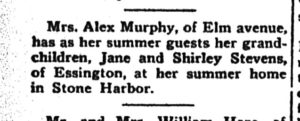
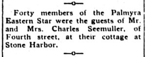
The social columns of the old hometown newspapers of Riverton and Palmyra (the Facebook posts of yesteryear) record many notices about local citizens’ summer plans.
Besides playing in the surf, our fondest summer memories may be about places we stayed, shopped, or ate.

EARLY BUSINESS GROWTH AT STONE HARBOR
by Harlan B. Radford, Jr.
As the population of Stone Harbor started to grow, a need developed for stores and other business enterprises to provide needed goods and services. The commercial development of Stone Harbor began around 1912 with continued housing construction and easier access to the island community, first by train and then by automobile.
A so-called commercial center or “downtown” began with the construction of the Shelter Haven Hotel, and before long, 96th Street became the primary shopping district. As one source* put it, “This vibrant shopping district exists because the Risleys recognized even though Stone Harbor was planned as a resort community, people who chose to make their permanent homes here would need more than just souvenir shops.” That same source declares, “As true a main street as one can find, Ninety-sixth Street is the heart of Stone Harbor.”
Let’s trace the early development of Stone Harbor’s business district with some vintage postcards.
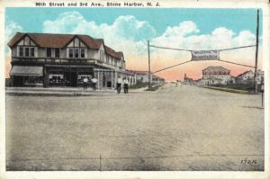
The sign stretching across Third Avenue at the intersection of 96th Street reads “WELCOME TO STONE HARBOR.”
This is where our story begins.
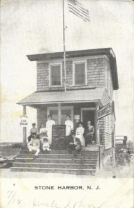
The two-story shingled restaurant owned and operated by H. S. VanLeer depicted in this postcard dated July 16, 1910, was one of the earliest businesses established in Stone Harbor.
Catering mostly at first to the construction workers and laborers, this store provided patrons with a quick lunch. The posted menu for “Dave’s Quick Lunch” on that particular day offered oyster and clam stew, sandwiches and coffee, soft drinks, ice cream, pies, cakes, and candies along with fresh fish. A 46-star American Flag flutters in the breeze atop the flag pole. The folks on the porch may be a mix of customers, staff, or owners.
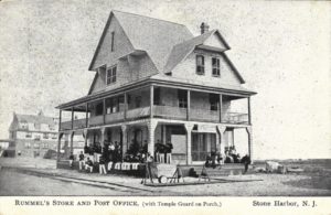
Rummel’s Store also served as a U.S. Post Office from 1894 to 1910. Located at 83rd Street and Second Avenue, this structure was very close to the Abbotsford Inn (later re-named Harbor Inn), shown in the background.
The young uniformed lads relaxing in the shade on the left side of the porch may very well be enjoying the same ice cream advertised by the sign over the steps. But just who are these young uniformed boys and what brought them to Stone Harbor?
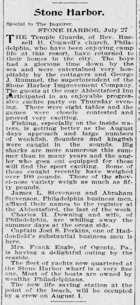
According to newspaper accounts, the boys, mostly around 16 years of age, were part of a group known as the Temple Guard, a military-type organization associated with the Grace Baptist Temple in Philadelphia.
Thirty members of the Temple Guard spent a two-week encampment at Stone Harbor from July 13-27 of 1895, during which they got a taste of a soldier’s life by drilling, marching, and engaging in other regimented activities.
This Baptist Boys’ Brigade had a daily routine consisting of drills, dress parades, and inspections, observing rank and following commands as well as performing duties and some hard work.
A schedule of social functions, athletic events, musical entertainment, and evening campfires with singing relieved the monotony of the military discipline and developed a strong sense of comradery among the group.
Founder and leader Reverend Russell H. Conwell, a veteran of the Civil War, saw in his boys the future of his church. Simply put, Rev. Conwell promoted and fostered learning and understanding of the value of strict military discipline along with training as a means to give young boys a foundation of life skills for their future lives.
In front of the store, three groups of rifles arranged in stack arms and a drum await retrieval by the brigade. Another group of people relaxes on the right side of the wrap-around porch in this remarkably preserved moment in time.
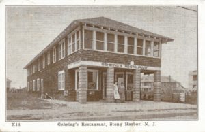
The sender of this mid-1920s postcard of Gehring’s Restaurant wrote to folks back in Allentown, PA, “This is where we ate our first supper. Hamburger. Yum-yum. And Blackberry pie a la mode too.”
Customary dress codes for men and women during this decade were more formal. Gentlemen invariably wore jackets and ties when eating at Gehring’s Restaurant, regardless of whether it was for lunch or dinner.
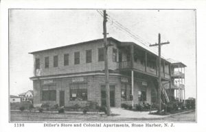
The well-known Diller’s Store appears in the foreground and the Colonial Apartments are just behind the variety store located at Second Avenue and 95th Street. By 1932 the Stone Harbor Post Office found its fourth home at Diller’s Store. Since there was still no mail delivery to homes and businesses at that time, people had to go to the Post Office to pick up their mail.
Troxel’s famous variety store on 96th Street appears below in three views taken at different times.
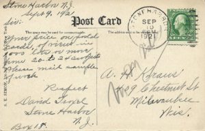
Since store proprietor David Troxel commissioned the printing of many postcards with early Stone Harbor scenes over the years to sell in his store, he played a significant role in preserving Stone Harbor history.
David Troxel himself mailed the black and white postcard view shown here dated September 9, 1921, addressing it to a producer and printer of postcards located in Milwaukee, Wisconsin to request a price list of postal cards for sale along with samples of work for large quantities of postcards in 1,000 lots or more from 20 to 24 subjects.
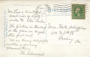
On the back of this card postmarked JUL 13, 1922, see on the far left side the inscription in blue ink, “Pub. for David Troxel, 96th & 2nd Ave., Stone Harbor, N.J.”
Can you spot the distinctive logos for Breyer’s Ice Cream in two of the Troxel postcards above?
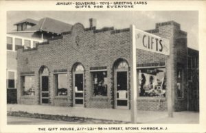
According to the caption at the top of this postcard, The Gift House, also located on 96th Street, offered “Gifts for Everyone” – including jewelry, souvenirs, toys, and greeting cards.
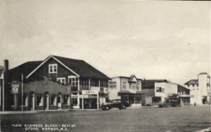
The Gift House appears again on the left of this scene titled” Main Business Block – 96th St.” along with several other establishments.
Taken from the tower of the Shelter Haven Hotel located at the intersection of 96th Street and Third Avenue, the circa 1913 photo below clearly shows the considerable undeveloped land that will soon undergo a significant transformation.
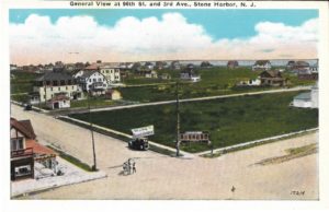
Note the large building shown in the background to the far left that was originally called the Duval Hotel. Shortly thereafter, the building was converted to Turpins Apartments.
Around 1939 the building became the acclaimed Springer’s Ice Cream Shop which is still in existence today.
The second of the two large buildings behind the Duval/Turpins/Springer’s building was Stone Harbor’s School No. 1 with four classrooms, located on 94th Street and erected in 1915.
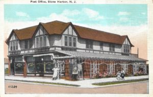
The postcard titled “Post Office” also displays a popular delicatessen in the large building at the corner of 96th Street and Third Avenue. Presumably, the man standing in front of this store was the proprietor. In all likelihood, the upper floor provided private living quarters for the owner and some renters.
These next two postcards reflect just how quickly and dramatically the 96th Street business district underwent change. Rapid growth occurred during the 1920s starting with the corner structure owned by Seamen and Letzkus with additional development leading to more shops.
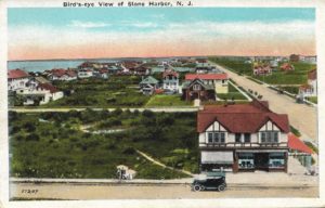
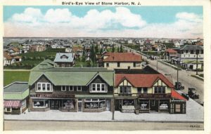
By the early 1930s, this block included Leon’s Market (one of the earliest grocers) as well as an A&P, or Atlantic and Pacific grocery store, along with the American Store and the Stone Harbor Fish Market to the far left with the red and white awning. As a result of further development and the construction of more private homes, open areas of land fast disappeared.
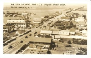
The real photo postcard captioned “Air View Showing 96th St. & Shelter Haven Basin” had to have been taken from atop the town’s water tower.
Looking west toward the entrance to Stone Harbor we see both the Parkway Bridge and the Ocean Parkway linking the mainland in the far distance. The iconic Shelter Haven Hotel appears in the upper left portion of this view. To accommodate more parking spaces for more cars in the growing downtown area the town devised angled-in street parking.
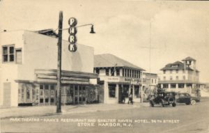
The very first movie house built in 1922 was originally called the Parkway Theatre which later simply became the Park. Next door, Martin Hahn, owner of Hahn’s Sea Food Restaurant boasted that he had the longest bar in all of South Jersey and the best crab cakes.
Farther west along 96th Street stands the nearby Shelter Haven Hotel. Movie theaters like the Park became very popular and provided a means of good family entertainment. An organist played live music to suit the action of the silent movies. Theater-goers had only a single screen showing the featured film and spectators sat in freestanding chairs. The cost of admission in 1927 was 30 cents for adults and 15 cents for children.
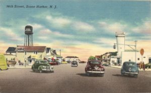
This late 1940s linen postcard shows the intersection of 96th Street and Third Avenue. The borough’s water tower is to the left and the second movie house called the Harbor is on the right.
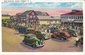
Parking is at a premium here on 96th Street at this very busy time at the “Bus Station.” Shoppers and “day-trippers” converge at the bus station for a trip home and moviegoers wait to see the current smash hit movie at the Parkway Theatre. Two movies shown there during the summer of 1927 included “LOVE” starring John Gilbert and Greta Garbo and “THE BIG CITY” featuring the illustrious actor Lon Chaney.
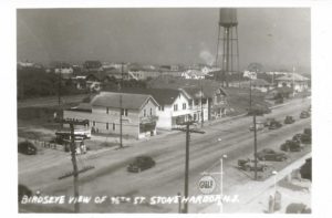
The rare real photo postcard at left depicts another “Birdseye View of 96th St.” about 1946 or 1947.
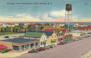
Even more economic development has overtaken the north side of 96th Street in this circa late 1940s linen postcard. Looking eastward, the ocean looms just 2+ blocks away in the background.
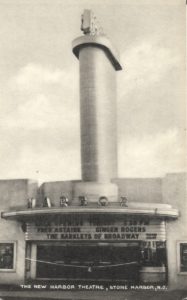
The “New Harbor Theatre” was built in 1949 and opened in 1950. This new movie theater became the second to show feature-length movies in Stone Harbor and they even offered plush seats for greater comfort. The marquee announces that the featured movie was “THE BARKLEYS OF BROADWAY” starring the ever-popular duo of Fred Astaire and Ginger Rogers.
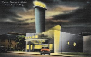
“THE GREAT GATSBY” starring Alan Ladd and Betty is appearing at the Harbor Theater shown in this color linen postcard.
This distinctive, quite bold, and very modern style of Art Deco architecture employed bold outlines, geometric and even zigzag forms as well as new building materials such as plastic.
We conclude this time-travel tour with a linen postcard from the 1940s looking west along 96th Street which marks the success and development of the downtown business district that would go on to make Stone Harbor such an enduring resort community.
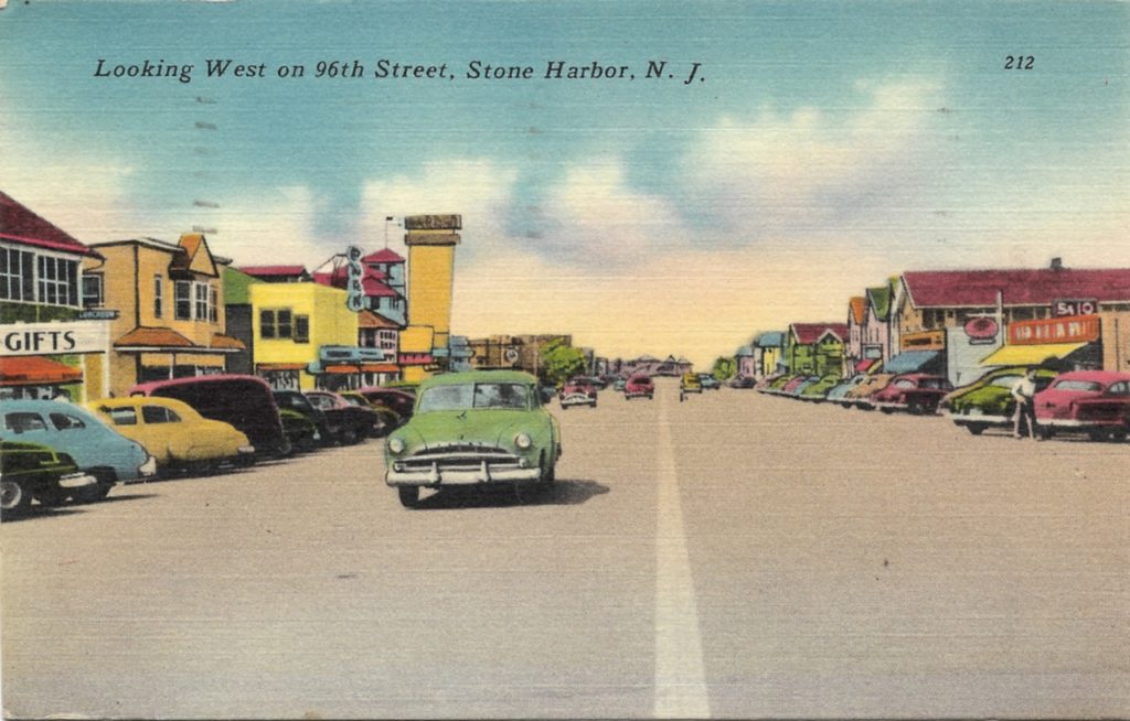
*Images of America: STONE HARBOR, REVISITED by Donna Van Horn and Karen Jennings – Published in 2016 by Arcadia Publishing – page 97
Mt. Zion marks its 125th Anniversary June 26 with a special worship service and unveiling of a historical marker
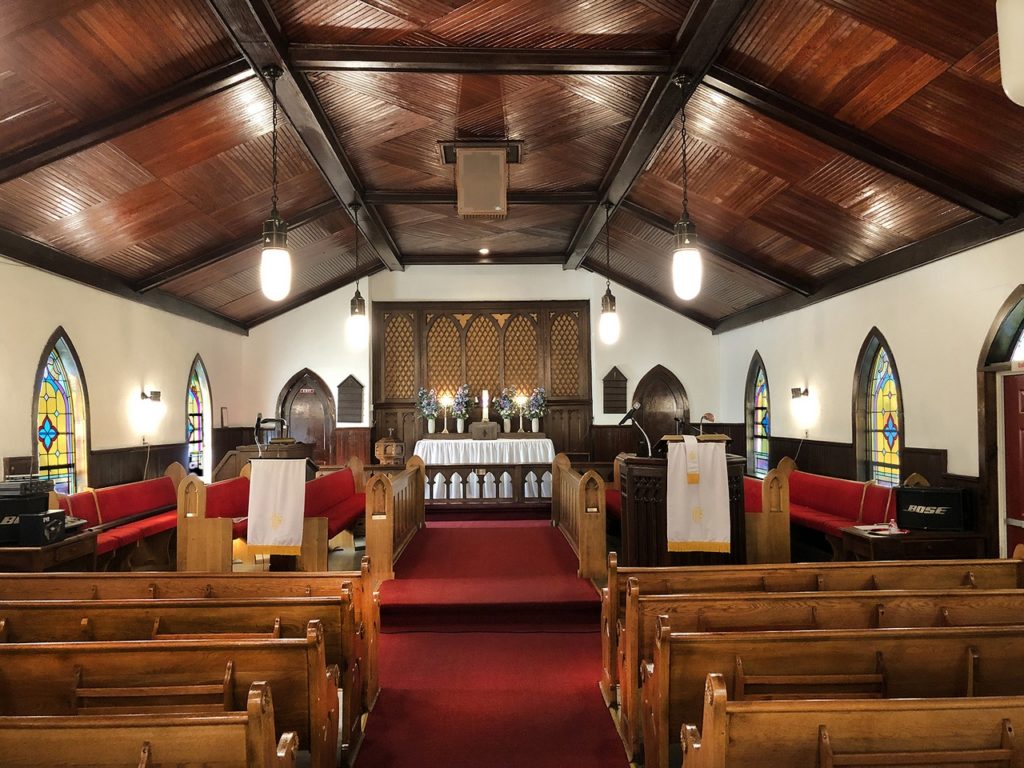
African Methodist Episcopal (AME) Church at 300 Penn St. will celebrate its 125th Anniversary on Sunday, June 26, 2022, with a special service at 10:00 am, to which all are welcome.
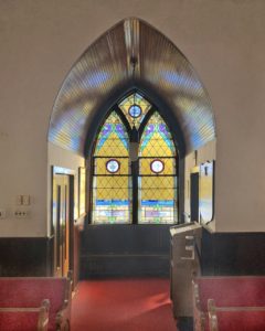
Following the service, at about noon, Mt. Zion will hold a dedication event out front by unveiling a new historical marker right on the corner of 3rd and Penn.
HSR Board Member and Borough Historian Roger Prichard worked closely with Valerie Still, Mt. Zion’s Pastor, The Rev. Dr. Leslie Robin Harrison, and Ann Marie Ross, a long-standing congregant, to research, design, and produce the illustrated historical marker.
The marker will inform its readers of the mission of the Mt. Zion AME Church begun in Riverton in 1897 as “…a welcoming refuge for worship and mutual aid.” It was underwritten by the HSR marker fund established with a contribution from The Historic Riverton Criterium
Please help Riverton’s Mt. Zion AME Church mark its 125th anniversary.
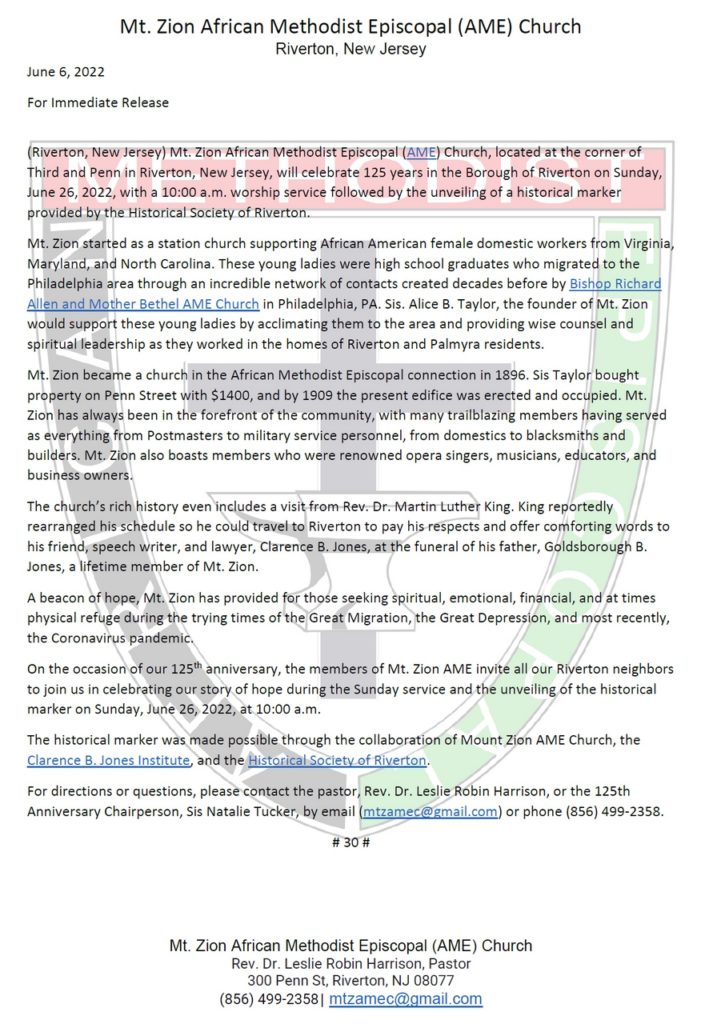
The church’s media release appears below.
See more from our archives about Mt. Zion:
History of Mt. Zion from 200 Years of Religion in Cinnaminson, Palmyra, Riverton, 1976
illustration from 200 Years of Religion
Mt. Zion photo from 1939 New Era
Mt. Zion fire, The New Era, Jan 14, 1932, p1
Goldborough B Jones obit, Courier-Post, Camden, NJ, 30 Nov 1962, p29
Ben Small wins Historical Society of Riverton’s History Writing contest
This just in from Heather MacIntosh Huffnagle, the person who conceived the idea to hold our November 2019 House Party, the proceeds of which established cash prizes to encourage Riverton high-school student authors to use primary sources to write about local history.
Congratulations to Palmyra High School’s Benjamin Small, the first-ever winner of the Historical Society of Riverton’s History Writing contest. We announced the challenge on April 1 and asked high school students residing in Riverton to describe in 1000 words how the historic context of mid-19th century America figured into the founding of Riverton. Essays were due on May 15.
Benjamin will be recognized publicly at Riverton’s Fourth of July ceremonies in Riverton Park. He will also receive a $500 check and have his essay featured on our website (see below).
Thanks also to Riverton School’s administrators, who gave us a list of schools their graduates attend. These include Palmyra High School, Moorestown Friends School, Holy Cross Preparatory Academy, Doane Academy, the Burlington County Institute of Technology, Paul VI School, St. Joseph’s Preparatory School, Camden Catholic School, and Bishop Eustace School. We reached out to each school, generally their counseling office, to share the contest news with their Riverton students.
We were extremely pleased with all of the essays we received. Many thanks to our members and supporters who have contributed to the Writing Prize fund. We raised about $4500 for this new program, the implementation of which was delayed by disruptions to education during COVID.
HSR Board Member and Borough Historian Roger Prichard also expressed his pleasure with the result:
Only just now had a chance to read the essays, and aren’t they a gratifying effort? And Ben’s is the clear choice as the winner – well-organized, engagingly written, amazingly free of errors – and he used endnotes! In Chicago Manual of Style format! Well done, indeed.
Oh, and nobody had mentioned Ben’s other connection with history. (Riverton’s ALL about connections!)
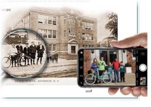
Ben appears on our HSR marker for Riverton School in the iPhone picture four years ago, updating the classic postcard view.
He’s second from the right in the red t-shirt, photo taken by our own Mrs. Dechnik on February 26, 2018.
All good stuff, makes me grin!
Thanks to Heather and her blue-ribbon committee for making this happen.
This link opens the PDF with Ben Small’s winning essay.
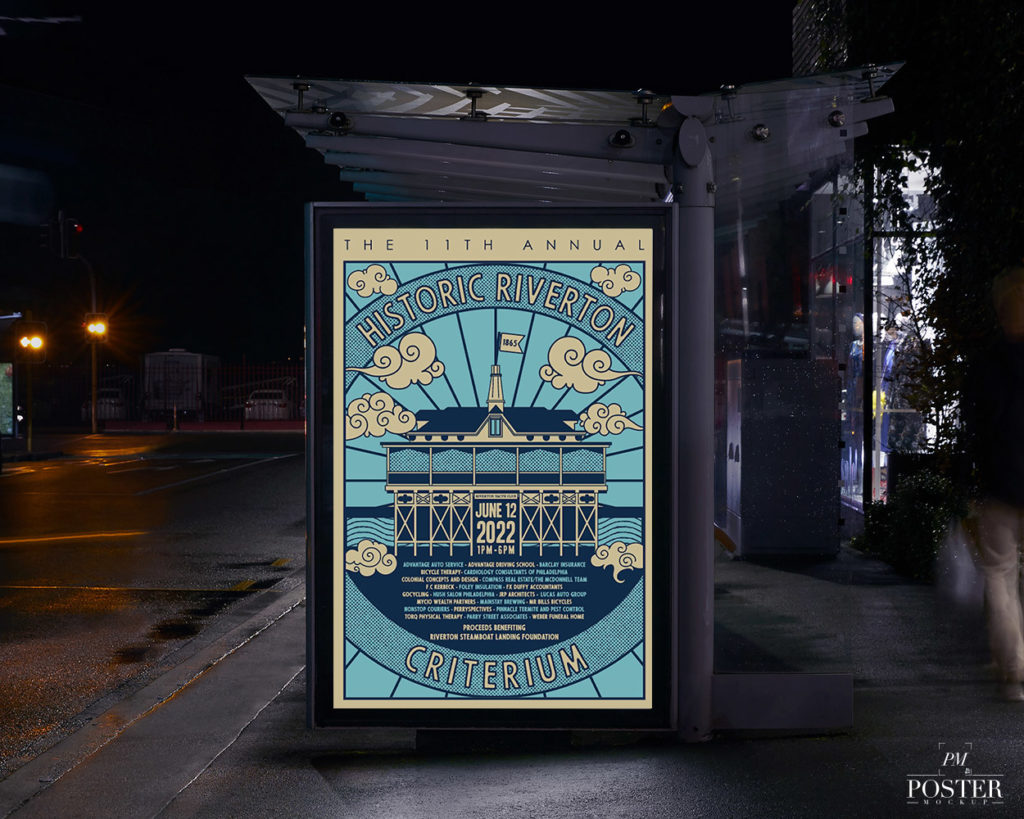
The HRC returns – is it a sporting match or a philanthropic endeavor? Emphatically YES!
This year it benefits the Riverton Steamboat Landing Foundation, an effort to raise money to ensure the pier, which holds the Riverton Yacht Club, remains safe and intact for years to come.
USA Cycling races (Women’s Novice/4, Men Masters 40+, Men 3/4, Women P/1/2/3, men P/1/2), kids races 7-9yrs.
Tee shirts, cowbells, Mama’s Meatballs, Mobile Madison, Tricycle Cafe, Dj Big Daddy Blake and crew!
Please leave your comments below and give some loves on Facebook to Carlos Rogers, the originator of the Historic Riverton Criterium, for bringing this exciting family-friendly event to Riverton in 2011. (We don’t talk about 2020.)
Carlos Rogers has quite literally made history in Riverton in more ways than one. Besides bringing back a new era of competitive bicycling to Riverton after more than a century’s absence, perhaps no other individual in Borough history has proven to be a more generous donor to worthy local causes than he has – over $40,000 so far.
Just search “criterium” in the box at the lower left and see more posts about the race and the extraordinary generosity of Carlos Rogers.
RPS 8th grader Ian Polaneczky earns the 2022 Betty B. Hahle History Achievement Award

At a special meeting on May 24, 2022, the Riverton School Board Meeting presented the 2022 Betty B. Hahle History Achievement Award to eighth-grade student Ian Polaneczky.
The Historical Society of Riverton has sponsored the award each year since 2007 in memory of Riverton’s First Town Historian, former HSR President, editor of its newsletter, and relentless champion of historic preservationist battles, Mrs. Betty B. Hahle.
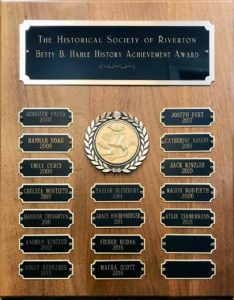
Ian received a $150 check and a certificate.
His name will be added to a plaque on display in a showcase near the school entrance.
Well done, Ian!
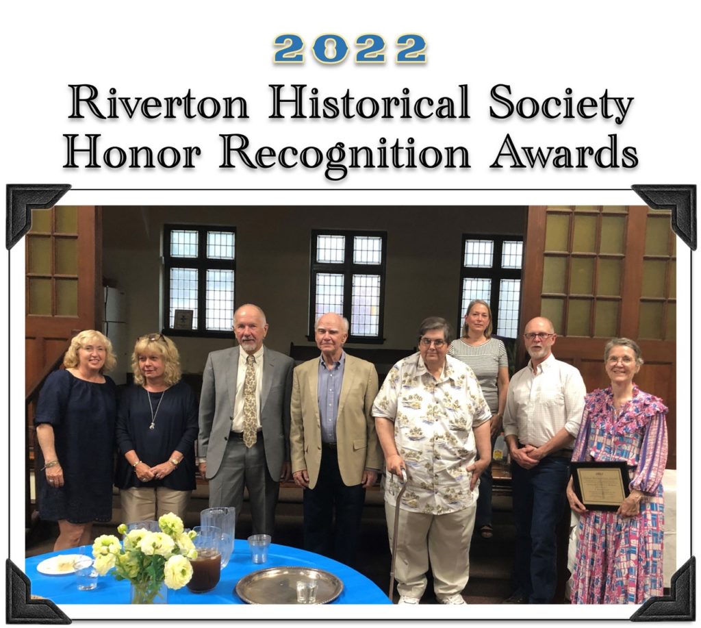
Honor Recognition Awards resumed after absence during COVID
Folks,
What a wonderful evening was had by all at last night’s Awards Presentation (May 19). It was held in the activities room of the Presbyterian Church, with a delicious cake from L&M bakery & iced tea. Thank you Phyllis and Pat for the preparation.
The recipients, T. Robins Brown, Tracey Foedisch, Nancy Grimes, Joe Rainer, Paul Schopp, and Steve & Sue Schwering, all seemed very pleased and thanked HSR for the honor that they received.
Thank you,
Bill Brown, HSR President

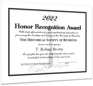 Board Members Pat Brunker, Iris Gaughan, Roger Prichard, Phyllis Rodgers, and Bill Brown each expressed our gratitude to the individuals and presented them with a framed certificate, a historically themed mug, and a copy of Riverton’s just published Images of America book. Their edited remarks follow.
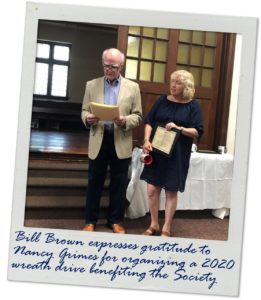 Bill Brown: Riverton for approximately 30 years Nancy Grimes has been a member of the 4th of July Committee, where she coordinates the Cocktail party.
She instituted a wreath program two years ago and donated the profits to the Historical Society of Riverton (2020) and to the Riverton Fire Department (2021). She fielded a small army of volunteers (with well-organized lists) who got them all hung in no time.
She was very active in the Riverton school as a member of the PTO. Nancy is community-oriented with a give-back attitude to help make Riverton a better place to live.
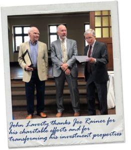 John Laverty: Joe Rainer has been up since 1 AM this morning handling the situation with the fire at his building at Broad and Main. He intends to get restoration work started immediately so that the affected business and apartments can be back in use as soon as possible…
…Joe started investing in properties in Riverton in 1986. He now owns 18 properties in Riverton, including nearly all of the commercial/mixed-use properties on the North side of the intersection of Broad and Main…
Joe is the Founder of Rainer Painting Company. Rainer Painting has… done charitable work in repainting the homes of military veterans in this area… painted Riverton Public School, The Riverton Fire Company Building, and the Riverton Police Station, and donated the materials needed for these projects…
We are very fortunate for the presence of his investments in our Town. So with the above in mind, I hereby present to Joseph Rainer this Recognition from the Historical Society of Riverton.
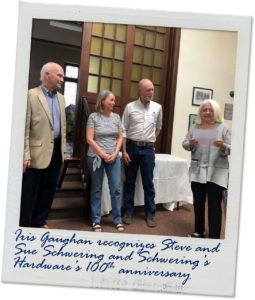 Iris Gaughan: Just about 100 years ago on September 25, 1922, Schwering’s Hardware store, then called Schwering’s Wayside Hardware opened its door for business. Steve’s grandfather was the first owner/proprietor. Schwering’s stock has changed many times over in the last 100 years, but what hasn’t changed is the professional and sincere service one always gets as a Schwering customer.
In the Gaughan household, it is a very rare week that goes by without at least 3 trips to Schwering’s.
Steve and Sue Schwering, congratulations on this Historical Society of Riverton recognition. You have continued to make Schwering’s Hardware a tri-boro community treasure. It is my honor to present you with this award.
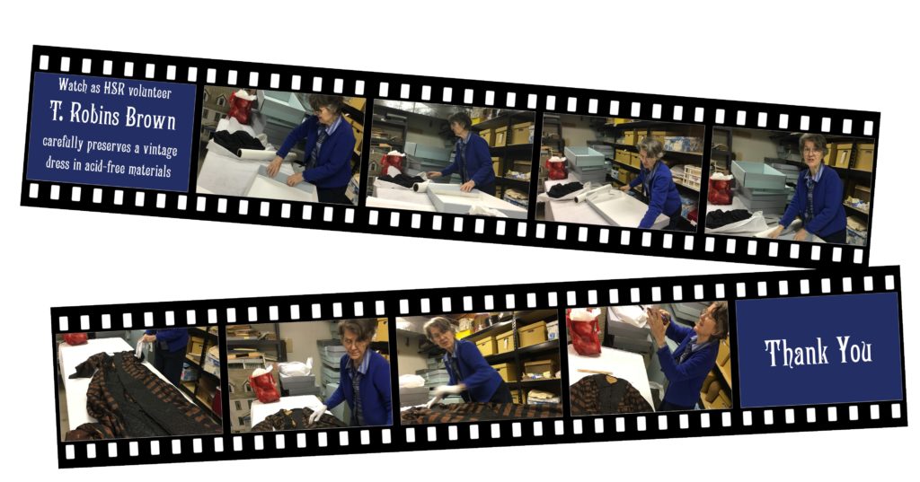
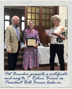 Pat Brunker: T. Robins Brown has worked on the HSR archives since January 2019, approximately once a week for a few hours at a time, cataloging our collection of artifacts. She has nearly completed the 300 items in our clothing archives and is waiting to put them into an accessible database when we get one.
She will move on to catalog the other artifacts in our collection. She has also researched the people who donated items and come up with a comprehensive story of their connections to Riverton…
We are indeed fortunate to have the expertise of this retired professional architectural historian and historic preservationist.
What she has done is amazing.
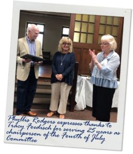 Phyllis Rodgers: It is my pleasure to introduce Tracy Foedisch as a recipient of the HSR Recognition Award. For the past 25 years, Tracy has devoted her time to making Riverton a very special place to live by serving as chairperson of Riverton’s Fourth of July Committee.
Each year she spends countless hours to ensure that Riverton’s Fourth of July encompasses numerous memorable activities. Her idea of working with Circle of Friends to produce the Concert in the Park added yet another layer of festivities to an already awesome holiday…
As Tracy plans her last year as Fourth of July chairperson, we wish her the best and are forever grateful for her dedication and service to Riverton.
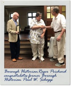 Roger Prichard: Paul Schopp has been researching and collecting information all his life about South Jersey, and specifically Riverton. He shares this passion for South Jersey professionally in his position as Assistant Director of the South Jersey Culture & History Center at Stockton University, where his work with their regional history publication SoJourn brings fascinating aspects of our past to life.
As a prolific contributor to our Gaslight News… his encyclopedic knowledge of these and many other subjects has been invaluable.
Even more than facts and context, Paul’s most lasting contribution has been to bring a professional’s skill at documenting HOW we know these things, an approach that has helped raised HSR’s activities well above those one might expect of the typical small, local historical society…
Paul has always insisted that we know what we’re talking about and we can document how we know that. The ring of truth always makes stories that much more engaging.
Until 2023, when we hope to acknowledge another group of people who have been instrumental in furthering our mission to preserve Riverton’s history.
“Research Your House” page revised
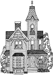 We added a new menu item to this website in 2016 to help folks find answers to one of the questions we get most: How do I find out about the history of my house, when it was built, who lived there, and when?
The centerpiece of the “Research Your House” page is a slideshow presentation that Patricia Smith Solin presented at a February 2016 meeting of the Society.
Pat has updated that work to present this May 2022 revision. In it, Pat walks you through the process by explaining basic research techniques utilizing HSR archives and online resources that will reveal the history of your Riverton home.
Watch as HSR volunteer T. Robins Brown carefully preserves a vintage garment in acid-free materials
May 2022 Gaslight News #191

President’s Message
This has been an exceptional year for the HSR Board and its members. The citizens of Riverton and we were united and concerned about the possible demolition of the Grove’s Mansion, located 409-413 Lippincott Ave. Attendance was considerable for the Zoom meeting hearings conducted by the Planning Board, with four straight months of evidence and legal arguments presented on our behalf. Thanks to the Planning Board’s decision not to demolish this beautiful historic home, we were successful. (See more details later in this issue.)
Also, the HSR had entered into an agreement with Arcadia Publishing Company to prepare a book titled “Images of America – Riverton.” Congratulations to Faith Endicott, Roger Prichard, and John McCormick for their hard work and efforts. What an impressive achievement! When they submitted the completed draft, the publisher called Faith to tell her that it was the best one they had ever produced.
HSR Board member and Borough Historian Roger Prichard has completed the research and layout for another splendid historical marker for a cherished Riverton landmark that will be installed later this summer.
If you find the articles, images, and historic hometown newspaper archive on our website of value to you, if you support our efforts to research and promote local history, please consider this an invitation to partner with us in our efforts with your membership or a cash donation.
Warm regards,
William C. Brown Jr
President, Historical Society of Riverton
Spunky historic town bucks national “teardown” trend
At less than one square mile, Riverton is a small town known for its distinctive older homes, most of which are listed on the National Register of Historic Places.
Citizen volunteers from all walks of life take on many roles here. Twenty-five years ago, Riverton volunteers inventoried and researched all historic properties and successfully placed Riverton on the National Register of Historic Places. Riverton’s Planning Board consists of unpaid public officials and volunteers who are charged with balancing the public good with private rights and interests as they guide the orderly growth and development of the community. Historical Society of Riverton volunteers research and celebrate the historic structures and advocate for their preservation.

Baltimore and Philadelphia Steamboat Company.
In this roaring real estate market, a developer targeted Groves Mansion, a historic residence on a large lot with mature trees, originally the home of the president of a steamboat company. He applied to the Planning Board to tear it down and squeeze in three new vinyl-clad houses on Riverton’s prettiest historic street.
It was an unusual test of Riverton’s strong Demolition Ordinance and this volunteer community’s resolve to protect and enhance it. The town has prevailed – for now.
The developer tried hard to demolish the mansion over four lengthy hearings but failed by a vote of six to three. Dozens of residents attended Zoom meetings, and many spoke passionately about the homes they had restored, believing that the historic area around them would be defended.
Ultimately, the developer could not prove what he needed to under the law. When pressed, he refused to make his engineer available to testify and even denied access to an independent engineer hired by the Historical Society to make a thorough, unbiased examination.
The developer bought the property even though it is not zoned for what he wanted. He took a business risk that he could get an exception to the historic protections. Not all business risks pay off.
This is one historic house teardown that didn’t happen.
– Roger Prichard
Reflections on our Arcadia Images of America book cover image
 How appropriate it is that our long-awaited Images of America book about Riverton will be on sale during Riverton’s Glorious Fourth this year!
There are over a hundred vintages with illuminating captions, many seen by the public for the first time.
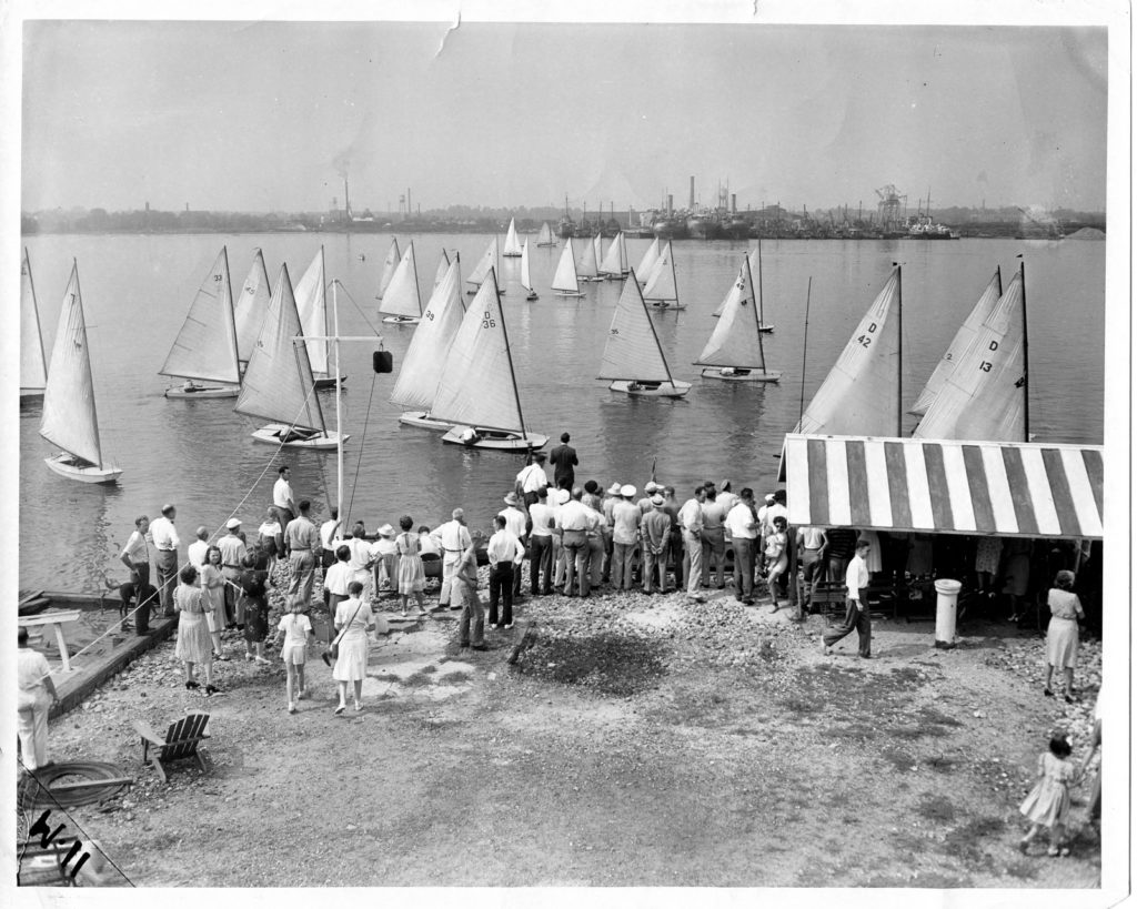
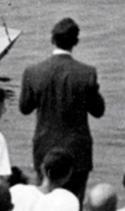 Consider the cover illustration showing the start of the very first Duster Nationals at Riverton Yacht Club that The Philadelphia Inquirer ran on Sunday, September 8, 1946.
See the snappy guy in the suit out in the center of the pier?
He’s a press photographer, probably from the Bulletin, since our photo is from the Inquirer.
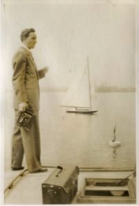 Here is a wonderful amateur shot of this dashing man taken by an unknown RYC member the same day.
I wish we knew his name. Don’t you love it – two newspapers covering a sailboat race in Riverton. Our man has his classic Speed Graphic camera at the ready.
This is how the shot appeared in the Sunday sports section of the Inquirer:
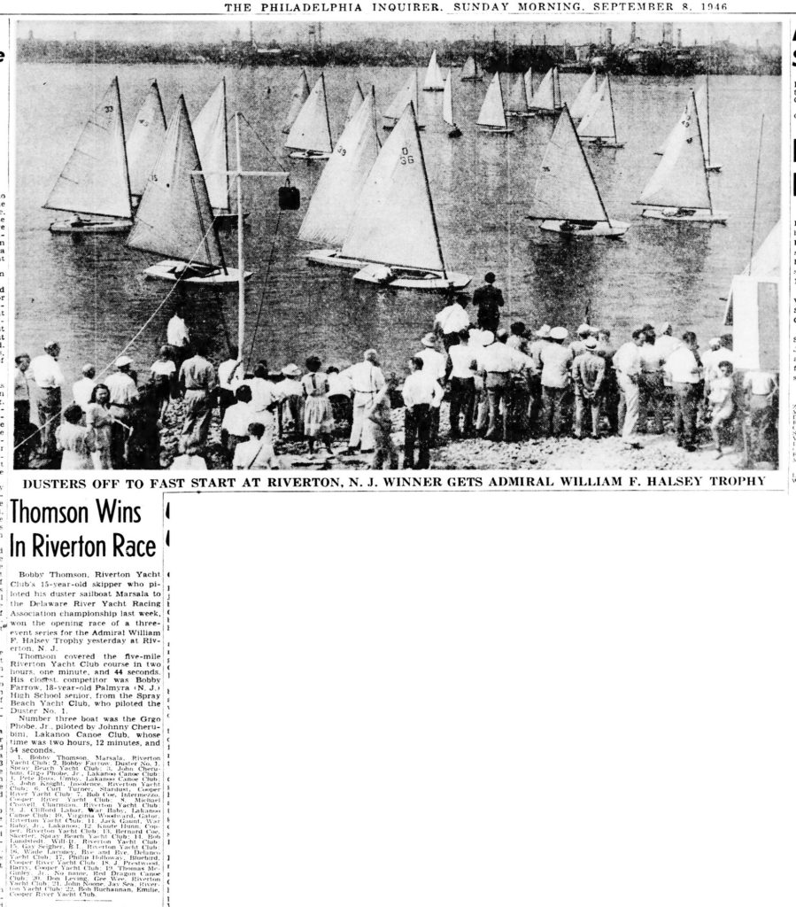
There is lots more going on in the crowd, and notice the group of ships across the river.

They are ex-WWII vessels in a scrap line. They were cut into pieces right there on the river’s edge at a scrapyard named Northern Metal.
Over the years, they cut up freighters, destroyer escorts, landing ships, and many other types of vessels. Later, a tanker built for the Navy for WWI arrived, but they didn’t cut it up.

Instead, they made it into a pier by sinking it. It’s still there, right across from RYC (the pier with the pointy end!). This was the 1917 USS George G. Henry. See her Wikipedia article under her later name, USS Victoria.
Because it was a bizarre operation, it was a major source of water pollution here, with all the residue of crankcase oil and fuel going right into the river.
Barb Smyth vividly remembers sailing Dusters as a kid and always wearing her oldest clothes because if you capsized, you’d have smears of tarballs on yourself that were impossible to get out.
And in that context, consider that some considered the Clean Water Act of 1972 a controversial “overreach” by the government.
River pilots and tugboat captains still refer to this spot on the river as “Northern Metals” when communicating on the radio, even though that company went out of business as a scrap yard over 40 years ago (and its actual name was singular, “Northern Metal”). The current scrapyard that appeared in the last five or six years is unrelated to the old one.
Some RYC kids of that generation who are now well along in years yearningly recall rowing over there at night to see what they could “liberate” from the ships while the night watchman slept.
It was a different world.
On July 4, 2022, our new 128-page Arcadia Images of America paperback book about Riverton will be available for $23.99 in front of Riverton Free Library at 306 Main Street. Richly illustrated with captioned vintage postcards and photos from our archives, the volume is sure to become a cherished keepsake for all Rivertonians.
– Roger Prichard
Memorial service for Bill Probsting at the Porch Club of Riverton, 11:30-1:30, July 4, 2022
We understand from Bill’s family that there will be a memorial service for him at the Porch Club on the Fourth of July. We reprint below our post from Oct. 9, 2021.
 William C. Probsting, a valued member of the HSR Board, passed away at his home in Riverton on Monday, September 20, 2021. A life-long resident of Riverton, Bill Probsting lived in the house on Howard Street that has been in his family for three generations. Bill was headmaster of Westfield Friends School from 1974 to 2013. After his retirement, Bill continued to serve his community through membership on the board of the Riverton Historical Society and through involvement with other non-profit organizations in the area. Donations in his honor can be made to the Riverton Historical Society and to Westfield Friends School.
We will miss him.
Our annual Recognition Awards Meeting will be held on Thursday, May 19, 2022, at 7 PM in the Presbyterian Church meeting room.

We sincerely thank Nicole Rafter, proprietor of The Early Bird, the new eatery at 519 Howard Street, for selling our exclusive historically themed mugs that display images from our extensive archive.
 She promptly sold out all 16 mugs and ordered another 16.
Milanese Pizza previously occupied that location and waaaayy before that, Silas J. Coddington moved his retail business there from the Price Building in 1919. You can catch a glimpse of the place in a scene from the 1926 Romance of Riverton film.

Isn’t it amazing how there is history everywhere in Riverton?
100 Years Ago
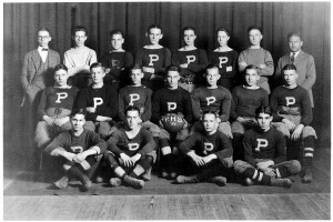
top row: Carl Latch/ 2-? /3-?/ Roy Kersey/ Frank Probsting/ Richard Graham/ Joe Joyce Coach Harry Ivory
row 2: English / 2-?/ Wally Sullivan / Calvin Boal / Horace Richman / Wagner / Carl Lutz
front row: Baxter / Gil Palphyman / George Becton / Harold Wood
Remember to SUBSCRIBE TO HSR VIA EMAIL
Enter your email address in the spot on the lower left side of the home page to receive notifications of new posts by email.
