Teacher at Riverton School 1974-2019, author, amateur historian, Historical Society of Riverton Board Member 2007-2023, newsletter editor 2007-2023, website editor 2011-2023
July 4th, 2020, the parade that never was. The coronavirus pandemic achieved what other epidemics, economic depressions and recessions, and two world wars could not. It caused Riverton’s treasured July Fourth Parade to be canceled. Here’s hoping we all get to enjoy the next one.
After folks received their July Fourth Program booklets this year, the question of the cover photo’s location arose.
Roger Prichard started it thus, and cc’d the whole HSR Board:
See this year’s program/ad book? I’m drawing a complete blank on the location for the photo… I just can’t place it for any location in Riverton.
Iris Gaughan, Pat Brunker, and others posited that it was taken on Main Street, but where? Our best resources, Nancy and Bill Hall were stumped, too.
Hypotheses involving angles of the sun and whether the parade was going toward or away from the river ensued.
Knowing that the Society had supplied the July 4th Committee with the photo, Roger asked to see the original photo scan to see if it might yield more clues.
Elsie’s scrapbook page
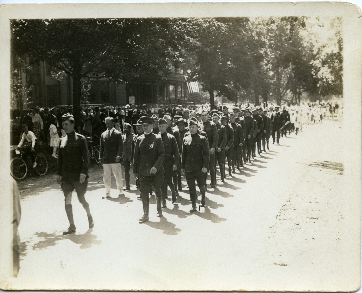
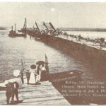
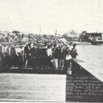
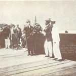
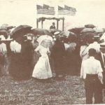
That photo was one of several taken by Robert Knight on July 5, 1920, the year when Riverton thanked over 100 servicemen and one woman, Army nurse Amanda Faunce, by presenting each with a gold signet ring during a ceremony at the riverbank.
Several of the photos appeared previously in the May 2017 Gaslight News article, “A Grateful Community” by Mrs. Pat Solin. Our esteemed past Board Member, Elsie Waters, since passed, had donated the treasured family photos to the Society.
When Roger received the scan with the entire image, he had his eureka moment.
July 5, 1920, photo by Robert Knight, donated by Elsie Waters
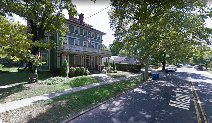
AHA!!! Thank you, John! That little bit of extra detail of the house with the cool porch in the background tells the tale! Look at those distinctive double columns and brackets for the 2nd floor porch.
Here’s what Mr. Google has. It’s 101 Main and the open space in the parade picture is where Ed Gilmore’s house and the modern one next to it were built (103 and 103a). That was always open space since the founding of the town.
Google maps screenshot, Main Street, Riverton
Thus ends another episode of history nerds group emailng each other, desperate to better illuminate the pages of Riverton history, since we have had to cancel all Board and membership meetings for the foreseeable future.
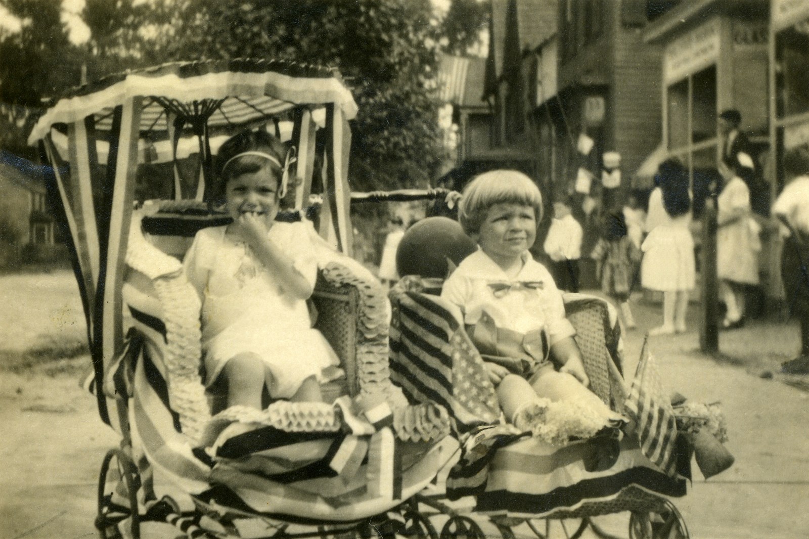
Elsie Showell and brother John, Riverton July 5, 1920
Incidentally, Elsie Showell Waters was not quite two years of age on July 5, 1920. She is dearly missed.
Please join the conversation here and on our Facebook page until we can resume normal operations. -JMc, Editor
Our huge collection of Gaslight News back issues has just become more accessible with the addition of a dropdown menu at the top of the Gaslight News page.
Just go to the Gaslight News page, rest your cursor on the “Select a Back Issue” box, and select any of over 180 issues from #1, published Dec. 1974 to present.
GN select an issue screenshot
We thank Michael Solin for adding this helpful feature and for doing so much more behind the scenes for the care and maintenance of our website.
HSR Pres. Gerald Weaber and Dr. Cliff Johnson confer as Mike Solin watches Ms. Cheryl Smekal explore the HSR website. In back, Jeff Chambers and Ms. Peggy Trauger Crook check out the site.
Former HSR President Gerald Weaber expressed our thanks to Mike in 2011 for customizing the website template that has made this record of Riverton’s rich history accessible to the public.
Over nine years later, Mike continues to generously volunteer his expertise to maintain and improve this website.
Thank you again, Mike, from your old teacher!
Warm regards,
Mr. McC
July 3, 2020: As the temperature soars this weekend and coronavirus restrictions ease, many folks are headed to the Jersey Shore. If you cannot visit for real, at least take a virtual vacation here and see hundreds of vintage postcard views of Long Beach Island.
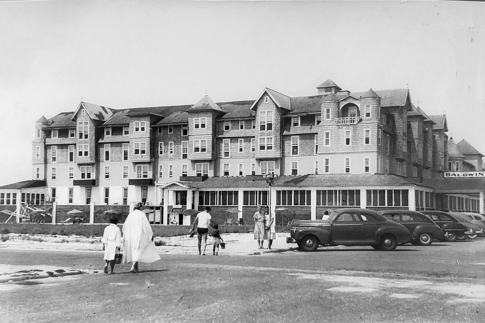
Baldwin Hotel, Beach Haven, NJ 1908
One postcard in particular seems to have become a magnet for attracting comments from visitors who have vivid memories of the Baldwin Hotel.
Paul Hughes writes from Arlington VA:
Marjorie Helgans
My mom worked as a waitress in Summer at the Baldwin during WWII. She needed that money for college as she was raised by a single mom in Jersey City and they had to scrape together all their nickels to get her through. She eventually went on to earn her Medical degree from Cornell Univ in NYC. She was always an industrious gal! I found a picture of her in her work uniform and a picture of the Baldwin Hotel in her personal items. She passed away in 2018 at age 92.
I immediately replied and offered to post the photos, which he in turn sent. Thank you, Paul, for this very personal addition to this online archive.
Her Mom (my Grandmother) is standing next to the street sign next to one of my Mom’s co-workers – Paul Hughes
If you have a comment, a photo or postcard, or any memorabilia that you wish to share on a topic found here on rivertonhistory.com please contact us at rivertonhistory@gmail.com or use the contact form below. – JMc, Editor
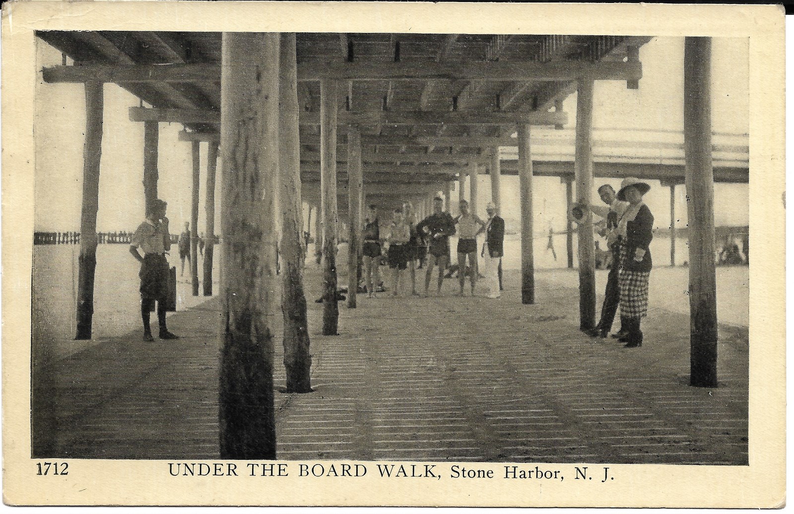
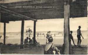
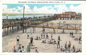
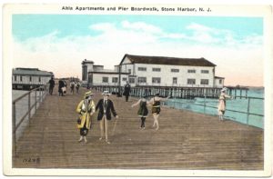
An avid postcard collector recently acquired this classic postcard on eBay. In it, a number of people find shelter from the summer sun under the boardwalk. A young man in knickers, the woman in a long checkered skirt and summer millinery, the fashionable man wearing white slacks and shoes, dark jacket, bowtie, and fedora, and a number of bathers are each captured as they posed over ninety years ago.
Postmarked APR 4, 1929 at Stone Harbor, NJ, and placed in the mailstream to a recipient at the Y.M.C.A. in Binghamton, N.Y., the penned message states, “My nose is all red and it isn’t from drinking either.” The postcard depicts the popular Stone Harbor Boardwalk before the Great Atlantic Hurricane of 1944 destroyed it. These chronologically arranged vintage views circa 1918-1944 document that long-gone Stone Harbor attraction.
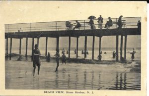
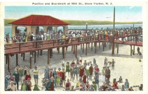
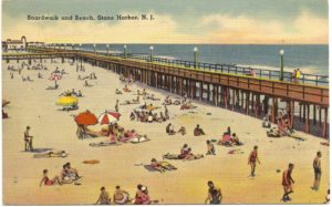
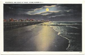
The Boardwalk at Stone Harbor, New Jersey
by Harlan B. Radford, Jr.
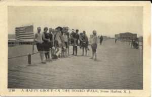
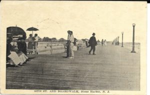
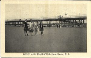
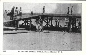
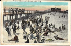
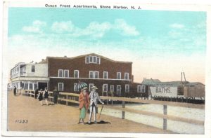
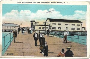
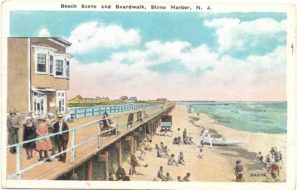
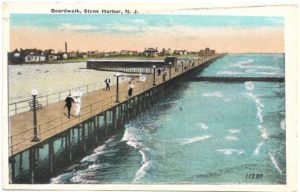
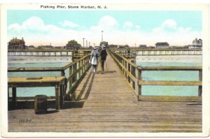
The boardwalk at the seashore resort community known as Stone Harbor, NJ is a distant memory that few can now recall. The following picture postcards and photographs serve as proof of the one and a half-mile long boardwalk from 83rd Street to 106th Street that once existed there for 28 years.
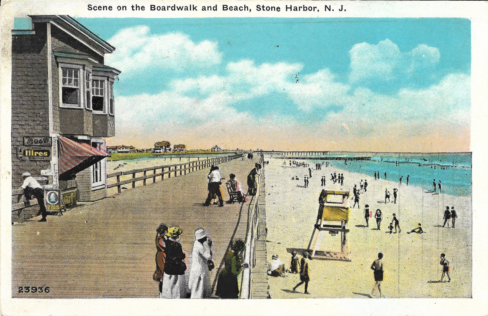
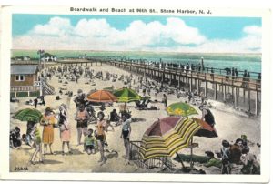
Scene on the Boardwalk and Beach, Stone Harbor, NJ Aug 15, 1927 Note Coca-Cola and Hires soft drink signs on building
The term boardwalk describes a walkway or promenade, often elevated, typically constructed of wooden planking, and is located along a beach. Atlantic City became the first seashore resort to construct a boardwalk back in 1870 to curb the amount of sand beachcombers tracked into the train and hotel lobbies. According to National Geographic, the State of New Jersey has 28 boardwalks and promenades – more than any other state.
Those of us who have personally experienced the charm of boardwalks at other locations, either today or yesteryear, are reminded of their immense popularity and the many attractions they offer. “Walking the boards” or leisurely strolling the boardwalk, often at the end of a day, provided countless opportunities for fun and relaxation including souvenir shopping, entertainment, arcades, miniature golf, saltwater taffy, and delicious fudge.
Greetings From Stone Harbor, NJ
If the number one attraction of the Jersey Shore is the sandy beaches, then boardwalks may be the second most popular reason why people flock to seashore communities during the summer months. Stone Harbor built its boardwalk in 1916. But we all know that mother nature and the mighty forces of the ocean have on numerous occasions not been kind to boardwalks and oceanfront properties.
Philadelphia Inquirer, Sept 16, 1944, p1, 16
Stone Harbor boardwalk’s reckoning came on September 14, 1944, when a particularly devastating storm, which became known as the Great Atlantic Hurricane of 1944, struck the New Jersey coast. Stone Harbor lost its entire boardwalk to this monster storm. The boardwalks of Sea Isle City, Atlantic City, Ocean Grove, Asbury Park, and Long Branch all suffered similar fates.
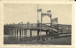
Residents assessed the extent of damage and the replacement costs associated with rebuilding not only the Stone Harbor boardwalk but also a 500-foot fishing pier out into the ocean and a covered pavilion at 96th Street. They agreed that there was a greater value of having unobstructed ocean views and consequently decided not to have the boardwalk rebuilt. A few resorts like Atlantic City and Asbury Park would rebuild.
In all my years of collecting postcards, one thing I have never seen is any view that shows the damaged Stone Harbor boardwalk immediately after that storm. If you have one, please share it.
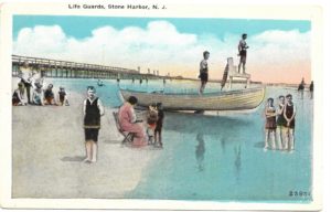
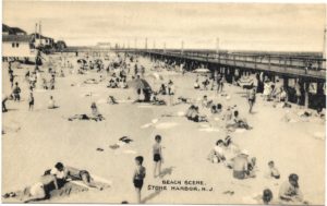
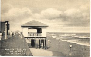
The following 38 vintage picture postcards featuring the Stone Harbor boardwalk are arranged in chronological order starting with views taken around 1918 and progressing to the time of the boardwalk’s sudden demise in 1944.
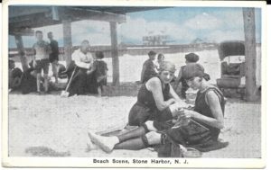
In the absence of the boardwalk, years later, beach umbrellas entered the picture and proved useful and popular as a means of escaping the direct sunlight on those hot afternoons. While we can only anticipate the reopening of shore businesses, beaches, and boardwalks in New Jersey and are excited for ‘Stage 2’ of Gov. Phil Murphy’s reopening plan, check out these views, and at least enjoy this virtual trip back in time!
We love this picture – her expression looks like her mother just told her very sternly, “now HOLD STILL!” It’s exquisite, the image just 2-1/2” high. So who was she?
Hint – her father built a number of houses here in Riverton. (Yeah, that hint wouldn’t have helped us, either…)
We love when our members and readers give us puzzles to solve. You never know where they’ll lead.
Recently, thanks to a reader’s inquiry sent to this website by Beverly DeFelice of Red Bank, NJ, whose father had collected tintypes and left her one of a little girl who was from Riverton, NJ. – from 1859 – we were faced with a mystery. Beverly knew the picture wasn’t of her father’s family, but who was it? She asked if we might know anything and does the family still exist?
(Tintypes, also called ferrotypes, were most popular in the 1860s and 70s and made with light-sensitive emulsion on a thin sheet of lacquered iron. They were much more durable than the previous photos on glass, such as daguerreotypes and ambrotypes and were very popular. The process was patented in 1856 so our example here is quite early.)
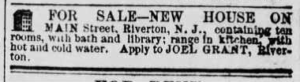
As you’ll see, it has a gold leaf mat and on the back paper is written, in fountain pen ink and old handwriting “Lois W. Grant, Riverton, N.J. Taken 1859. Age 6 years.”
But the picture wire and screweyes don’t feel like 1859 and neither does the sticker that says “Darmstaetter’s, Lancaster PA.” What’s that about?
Nothing about this rang bells, but then, with a little digging …
Ancestry.com is a great place to start. A single search of that name, in Riverton, with that approximate birthdate, and – bingo – we have the 1860 Census that shows her living in a family of 6. Unfortunately, there were no house numbers in those days, but this starts us on our quest. Her father’s name was Joel Grant, and his occupation was “carpenter.”
For those with access to an Ancestry account, we have a huge public tree we’ve been working on, called “Early Families of Riverton NJ” and we added Lois and Joel and a number of relatives to it. Have a look here: https://www.ancestry.com/family-tree/tree/108021762/family/familyview?cfpid=322186642113 (You can also use the “Tree Search” button to look for anyone else we’ve been adding, Biddles, Parrishes, etc.)
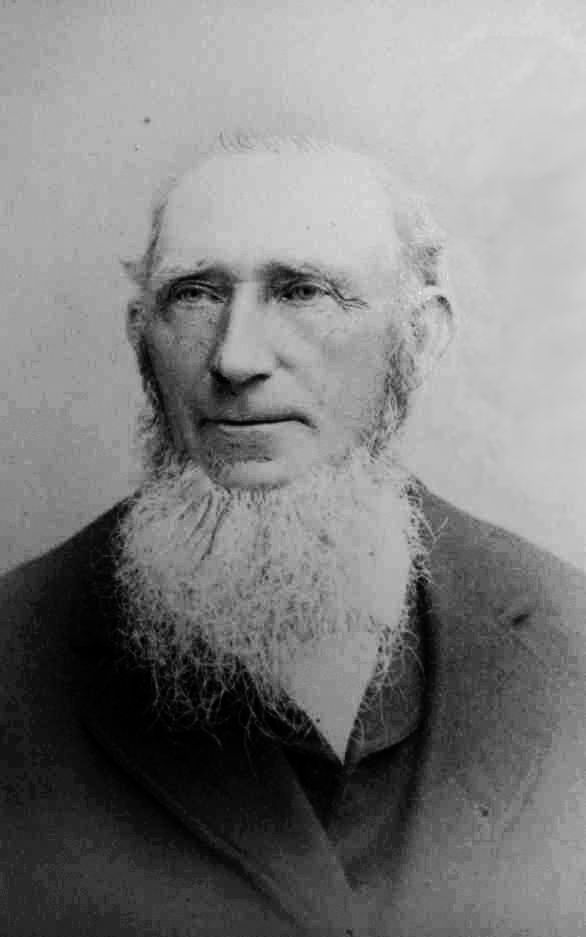
Joel Grant photo coll. Randall Coury on Ancestry
With his name, we find that more than one Ancestry user has made a tree that includes this Joel Grant – and one of them has a picture of him! Now we know what her father, that early house carpenter in Riverton, looked like.
So now we have a name of the grownup, let’s dig further …
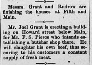
Since it’s a PDF, it’s easy to search for “Grant” and – wow – it turns out that our little girl’s father, Joel Grant, was the builder (and real estate developer on a modest scale) who gave us several buildings which still stand today.
Riverton National Register Historic District Inventory:
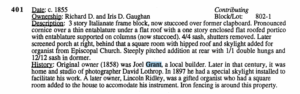
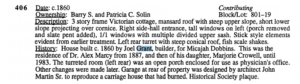
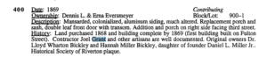
Those buildings are: 401 Main, c. 1858; 406 Main Street, 1868; 400 Fulton Street, 1869; 521 Howard Street, 1881 – probably the “butcher shop of Mr. F. S. Pierce,” today much altered.
There were likely others, of course.
401 Main Street, (c. 1858), PHOTO by Roger Prichard
406 Main Street, (1868), PHOTO by Roger Prichard
400 Fulton, (1869), PHOTO by Roger Prichard
521 Howard Street, (1881), PHOTO by Roger Prichard
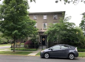
Since HSR board member Iris Gaughan and her husband Richard own 401 Main Street and they’ve recently researched all of the deeds for their house, it was an easy matter to find that our Joel Grant actually owned it for a long time, from 1858 to 1872. Could this have been their home at the time of shy little Lois’ photograph?
detail from 1860 Stone & Pomeroy map shows Grant at 401 Main
Indeed – we have a map! Attached to the National Register inventory is a dim copy of the Riverton detailof the 1860 Stone and Pomeroy Map of the Vicinity of Philadelphia, with the principal houses identified, and by golly, this one is marked “J. Grant.”
Guaranteed, this is where the little girl lived when her picture was taken.
So what became of the Grants, do they have surviving kin, and why was the tintype framed in Lancaster?
More fun with Ancestry.com and Newspapers.com came next.
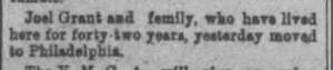
Lois married Isaac Eastwood in Riverton in 1878. He was a traveling salesman of dental supplies. They seem to have lived with her parents, even after moving to Philadelphia in 1895, and never owned their own home. Lois’ mother died in 1901, her father Joel the house carpenter died in 1904, and Lois and her husband boarded thereafter until his death in 1917. His death certificate reads “cirrhosis of the liver,” an indication of long struggles for everyone.
Lois went to live in Upper Darby in the home of her grown daughter Ellen (“Ella”), and her husband, who had a nice new home in Upper Darby. He was also a traveling salesman.
The 1920s seem to have been quietly domestic for them. In 1934, our Lois died there at age 80 but then Ella lost her husband, Ralph, just three years later to a heart attack in 1937, at just 57 years of age.
Ralph had come from Lancaster County, so Ella moved there at some time after 1940, probably to live with or near her in-laws.
This would explain the “Darmstaetter’s” label on the paper on the back of the frame. Google tells us that Darmstaetter’s was a long-time photo and stationery store on Queen Street in Lancaster, so it’s easy to picture that, once she had settled in Lancaster County, Ella must have had the store reframe the tintype of her mother.
We can safely assume, then, that the fountain pen writing on the back is in Ella’s hand, recording for us the facts about her mother Lois.
Ella died there in 1953. She and Ralph had just one child, a son Robert, who was also a traveling shoe salesman like his father. He was single and had lived at home until he married at 37. At some point he went to work for the Reading Railroad.
Robert had no children, dying in 1992 at age 80.
So now we know, Lois has no living descendants. We contacted the family member on Ancestry who had the picture of Joel Grant (a descendant of one of Lois’ brothers). He was fascinated with the story but he and Bev agreed that it’d be best for the little tintype to have its new home here in our archives.
We’ll never know how Robert’s cherished photo of his grandmother in 1859 made its way to Bev DeFelice’s father’s collection, but we are very grateful to Bev for taking on its stewardship and bringing it home to Riverton.
Thank you, Bev! Moral of the story: always write names and dates on the backs of photographs! Without that, this would have been just another little picture that had lost all its meaning. (Now, how do we do this with digital photographs? …a topic for another day.) – Roger Prichard
Hey, kids, raise your hand if you remember dealing with any of the businesses advertised on this June 6, 1932 New Era Business Directory.
Business Directory, The New Era, June 9, 1932, p5
Now, for extra credit, how many businesses listed there are still in operation?*
Businesses have come and gone over the years, but let’s not let COVID-19 be the reason that a local business can no longer thrive.
We all long for those times when we could patronize local stores unencumbered by masks, counter shields, and social distancing.
We look forward to June 15 when most — but not all — nonessential retail businesses in New Jersey will be allowed to reopen with shoppers inside stores; capacity will be limited to 50% and both customers and employees will be required to wear face coverings to protect against the coronavirus.
We thank all of the essential businesses that have opened under difficult circumstances.
We urge you to show your appreciation to local businesses by helping them to recover from the shutdown and again prosper.
Schwering Hardware, possibly first ad in Palmyra Weekly News, Sept 22, 1922
*Yeah, you got it.
Schwering’s Hardware has endured depressions, recessions, wars, and now a pandemic! Steve and Suzanne Schwering will celebrate the absolutely essential establishment’s 100th birthday in 2022.
Disastrous Storm, Camden Democrat, July 26, 1873, p2
The aftermath of the recent violent derecho storm system reminds us of other times that Riverton has suffered at the hands of Mother Nature.
tree near Cedar Street, Sept. 2013
In our own memory, we recall other trees downed from storms, but this time there were so many, not only here, but in surrounding towns of Palmyra, Delanco, and Palmyra, that PSE&G crews have been overwhelmed trying to restore power.
Please send us your photos and recollections of storm damage from this incident or from others back in the day.
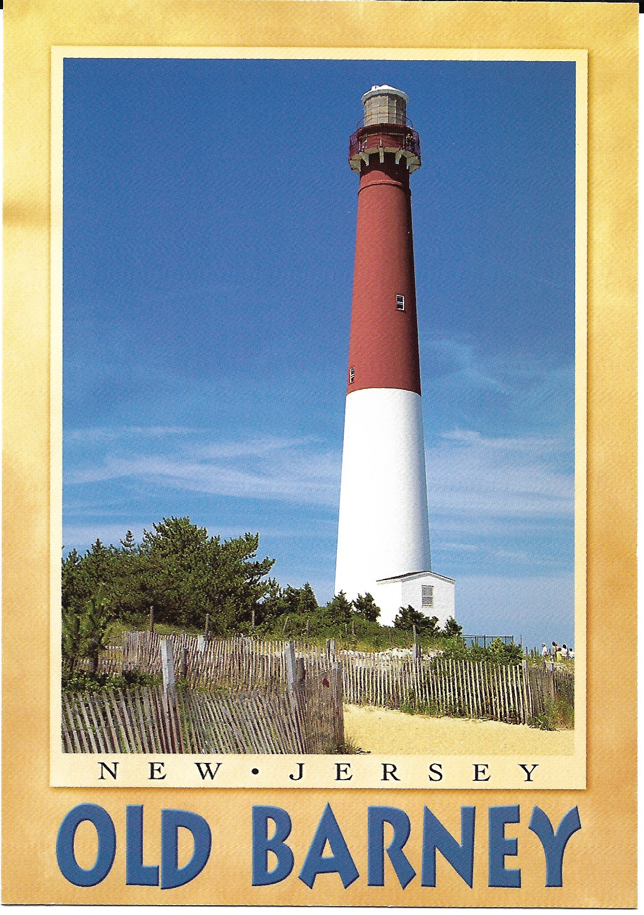
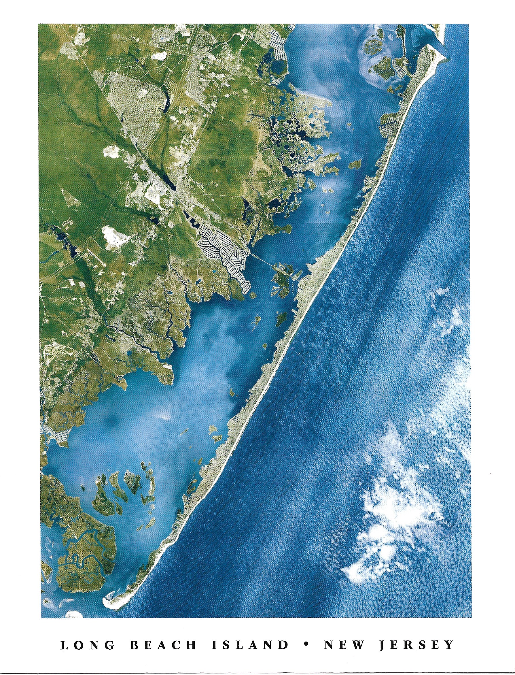
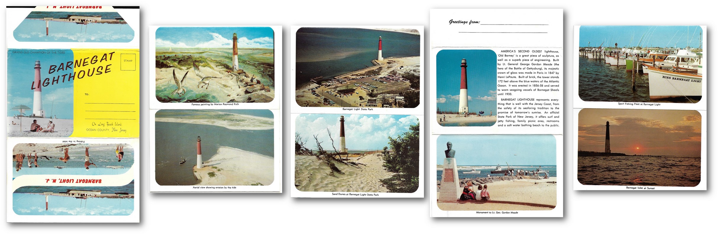
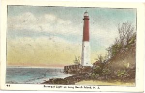
Affectionately called “Old Barney” and one of New Jersey’s best-known landmarks, the iconic lighthouse known as Barnegat Light is located on the northern tip of Long Beach Island and on the south shore of Barnegat Inlet. Mariners considered the Barnegat Lighthouse one of the most important “change of course” points for coastal vessels bound to and from New York along the New Jersey coast.
Its essential purpose was to warn ships away from the treacherous and shifting shoals which extended out from the shore. This particular area was very dangerous as ship captains had to contend with not only the shifting sandbars but with mighty currents as well.
Long Beach Island, New Jersey
Numerous illustrations and picture postcards both old and new will provide some historical background about the famous Barnegat Lighthouse.
What makes Old Barney so distinctive and recognizable as a navigational landmark is her colorization or her “daymark” features – that is to say the lighthouse has a red upper half and a white lower half. Barnegat Light as we know it has remarkably endured and served for 160 years!
Author Glenn D. Koch in his informative 2007 coffee-table book entitled “Picturing Long Beach Island” makes a good case for calling the Barnegat Lighthouse an iconic symbol that has become synonymous with Long Beach Island. Koch elaborates:
Her familiar red and white pattern of paint is immediately recognizable to anyone who has ever seen it. Her iconographic image has appeared on everything from bank checks to calendars to milk bottles and continues to appear on thousands of other souvenirs year after year. Since the earliest days of the postcard, publishers have been capturing and producing her image.
In 1834, Barnegat Light became the fourth sentinel on the New Jersey coast. Only 40 feet tall and with a very limited and dim beacon, this tower would soon prove itself to be wholly inadequate as the shipwrecks and groundings in that vicinity continued.
The passage of just two decades brought forth plans for the construction of a new and higher first-class lighthouse tower in 1856 with a considerably more powerful first-order lamp. Half-way through the construction of this new light, the original structure succumbed to the continual onslaught of the ocean. The replacement, which endures today, stands 170 feet tall and is situated some 900 feet from shore.
The only way to reach the top is by ascending 217 steps on a winding staircase. West Point graduate George Gordon Meade who later led Union troops during the Battle of Gettysburg during the American Civil War hero engineered and supervised its construction.
The original light assembly, known as “Old Barney’s Eye,” was eventually removed and now resides at the Barnegat Light Historical Society Museum
The completion and official opening of this replacement lighthouse occurred on January 1, 1859. Its twin walls of brick, range 27 feet in diameter at the base to less than 15 feet at the top. A glass lantern house topped the tower. Interestingly, the original light assembly, known by some as “Old Barney’s Eye,” was eventually removed and now resides in the Barnegat Light Historical Society Museum located at 501 Central Ave, Barnegat Light, N.J.
Henri Lepaute of Paris fabricated that light assembly from glass made at the famous French Furnace at St. Gobian. It consists of 1,024 separate prisms mounted in bronze fittings forming a lens eight feet in diameter and fifteen feet high. Delicately balanced on heavy bronze rollers, the five-ton light could be rotated simply by the pressure of one’s little finger.
The original lamps were kerosene and consisted of five wicks of one, two, three, four, and five-inch diameters all placed within the other. The reservoir for the lamps held ten gallons of oil, consuming four and a half gallons a night in the summer and as much as seven and a half gallons a night in the winter. This fuel had to be carried daily by hand all the way up the spiral staircase to the light at the top.
Rotation of the light was accomplished by a 150-pound weight that was hung on a 65-foot steel cable and the entire mechanism operated much like the weights found in a typical grandfather clock. Is was said that Barnegat’s light had to be wound once every hour and that the lense revolved once every four minutes giving 24 distinct flashes, each lasting two seconds. The so-called “light characteristic” of Barnegat Light was determined to be a flash every ten seconds at each point of the compass and it had a range of twenty nautical miles.
A few years after the tower was finished, a two-story wick-house was added. Then in 1889, a large cottage for the lighthouse keepers and their families was completed. This 20-room, two-and-one-half story building consisted of three Victorian cottages that accommodated the keeper and his two assistants, who not only maintained the light but tended to the surrounding grounds.
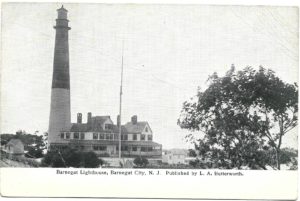
Barnegat Lighthouse, L.A. Butterworth, pub.
Barnegat Light, Barnegat City, NJ
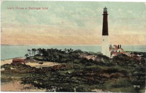
Light House at Barnegat Inlet
Barnegat Light, Aug. 30, 1906
Typically the lighthouse watch was divided into three daily shifts which occurred from sunset to 10PM, 10PM to 2AM, and 2AM to sunrise. Once a lighthouse keeper came on duty, he could not leave. It would take three men – a keeper and two able assistants to maintain the lighthouse each shift. It was vital that the lightkeeper kept the light turning and operational at all times.
Unfortunately, it would not be long before the relentless pounding of the ocean, tides, and storms undermined the keeper’s house and by 1920 the remains were torn down.
The known lighthouse keepers in sequence to 1936 were as follows: 1. James Fuller, 2. Burch Brown, 3. Jack Kelley, 4. Joshua Reeves, 5.) Thomas Bills, 6. William Woodmansee, 7. Clarence H. Cranmer, 8. Andrew E. Applegate, 9. Robert E. Applegate and 10. William E. Rothes.
Over the years that have followed, men constantly struggled with nature and battled the inevitable erosion and storms. They undertook the construction of a number of rock jetties to try and slow the loss of land close to the inlet.
Beginning in 1943, during the construction of one such north jetty, two massive steel towers were built with cables strung across the entire Barnegat Inlet with one tower near the lighthouse on Long Beach Island and the other tower located on the other side of the inlet on the southern tip of what is known as Island Beach. One by one, on slings across the inlet, large granite boulders were carried by way of the strong elevated cables across the inlet and placed on railroad flatcars and taken by rail for placement by a crane to create the jetty. This huge undertaking took a couple of years to complete and was essential to preserving the integrity of the land area around the lighthouse itself.
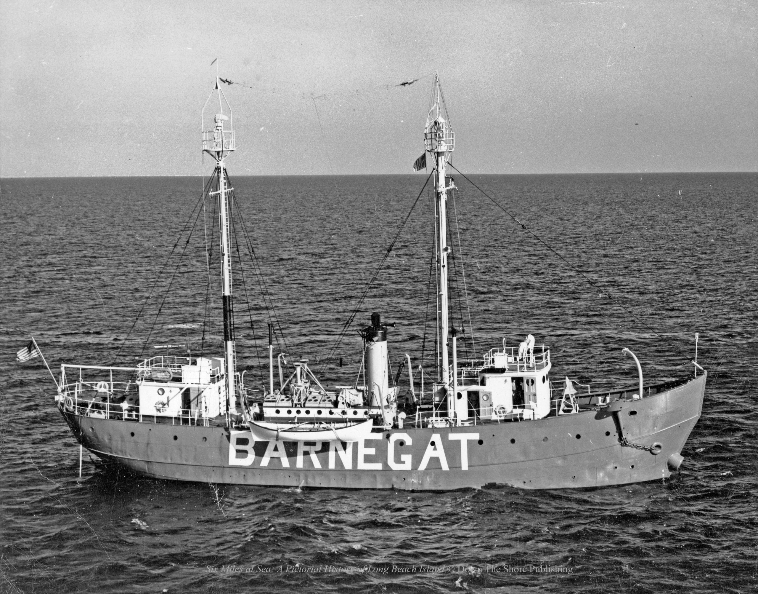
By 1927 Barnegat Lighthouse was decommissioned, the beacon went dark and the entire property was turned over to the state of New Jersey. From that point on to 1965, Barganet Light was replaced as a beacon by a lightship bearing the same name “Barnegat” that was manned by a crew of fourteen and anchored eight miles off-shore.
This new type of lightship was twin-masted and its role was to warn commercial ships of shallow water and shoals. Atop each of the masts were three oil-fed lanterns. In addition to a bright light at 8-second intervals, the ship was capable of emitting a loud steam-chime whistle every 20 seconds and during foggy conditions, there was a fog horn capable of being heard a distance of four miles. Over time, this lightship method became obsolete and after 38 years it was removed and replaced with radar and electronic means of navigation.
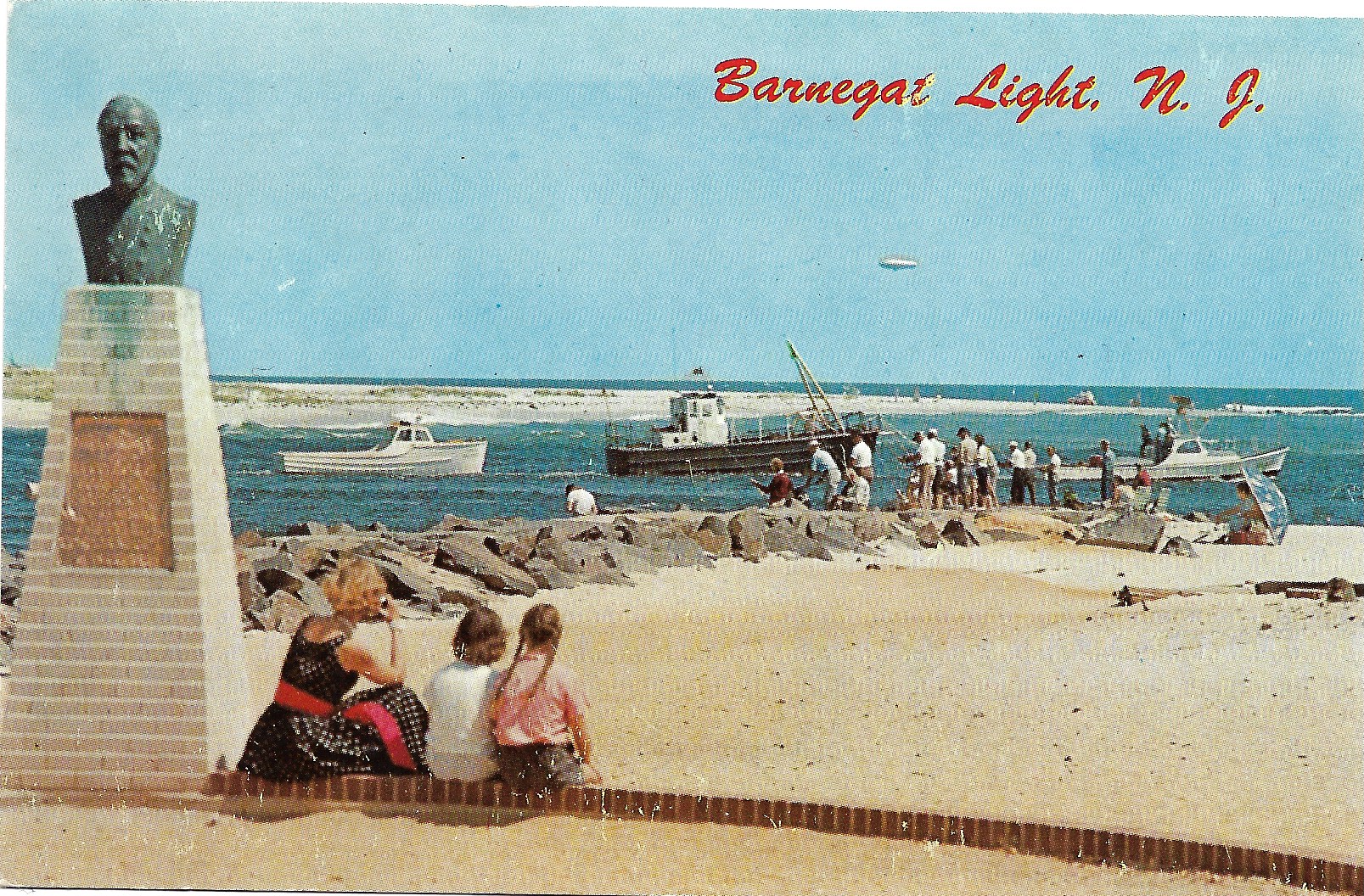
A bust of General George Meade overlooks the ocean at Barnegat Light State Park1951, Barnegat Light designated as a State Park; formally dedicated 1957
For a while during the Second World War, the U. S. Coast Guard used Old Barney as a look-out station to keep watch for German submarines off the Jersey coast.
When world peace was restored the lighthouse was taken out of service and the site reverted back to control by New Jersey. In 1951, Barnegat Light was designated as a State Park and by 1957, the park was formally dedicated and a monument consisting of a plaque, and a bust of General George Meade was unveiled at the base of the light overlooking the ocean.
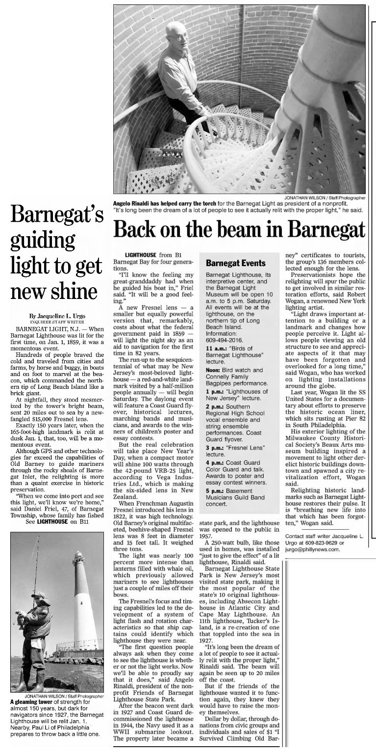
The Philadelphia Inquirer, Oct. 5, 2008, p B11
In 1988, Barnegat Light closed for renovations and needed repairs. Work concluded three years later and Barnegat Light re-opened once more for visitors. After some 150 years, the famous landmark sported a new automated light on January 1, 2009, and thanks to preservationists was ceremonially re-lit to the delight of many.
The Philadelphia Inquirer, Jan 1, 2009, p B07
In order to satisfy Coast Guard specifications, this new light had to be an actual aid to navigation and not just a mere beacon. Happily, the current apparatus, a 100-watt, 42-pound VRB-25 light, imported from New Zealand satisfies and meets all Coast Guard requirements. Long may Old Barney’s light continue to beam brightly into the future.
Today, Barnegat Lighthouse State Park is New Jersey’s most visited state park, making it the most popular of the state’s ten original lighthouses, including Absecon Lighthouse in Atlantic City and Cape May Lighthouse. During normal operations, Barnegat Lighthouse is open to the public on weekends during the months of May, September, and October. The lighthouse is open every day beginning Memorial Day through Labor Day. Find current details and information here.
This author recalls times as a young child when in the late 1940s my father photographed me standing at the base or even atop Barnegat Lighthouse while on summer vacation to Harvey Cedars.
Anna Radford, Moorestown, NJ with son, Harlan Radford, 2000
Many years later, my mother and I ventured back down to the Jersey Shore and Long Beach Island and re-lived some distant memories at our favorite lighthouse. It was still possible then for my mother to climb those 217 steps to the very top with me and we marked our celebratory moment with a photo.
Helen-Chantal Pike in her 2001 book “Greetings from New Jersey: A Postcard Tour of the Garden State” by way of introduction explains the popularity of picture postcards:
Sending postcards began as a fad in the final years of the nineteenth century as travel happy Americans began scribbling their sentiments on thin, three-and-a-half-by-five-and-a-quarter-inch pieces of cardboard whose front sides were printed with a local view. In 1908 the United States Post Office Department delivered a staggering 667,777,798 postcards.” The little cards solved a lot of communications problems especially for those of few words or for those who didn’t like writing letters.”
It is not surprising that so many personally penned messages appeared on postcards over the years with the brief phrase “Wish you were here!” What memories do you have of Barnegat Lighthouse?
Appendix
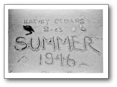
Barnegat Light bank checks issued by The First National Bank of Barnegat
A.) The First National Bank of Barnegat, New Jersey issued 10 different variations of bank checks depicting Barnegat Light over the span of years from 1917 to 1944.
B.) New Jersey Division of Motor Vehicles “Shore To Please” License Plate
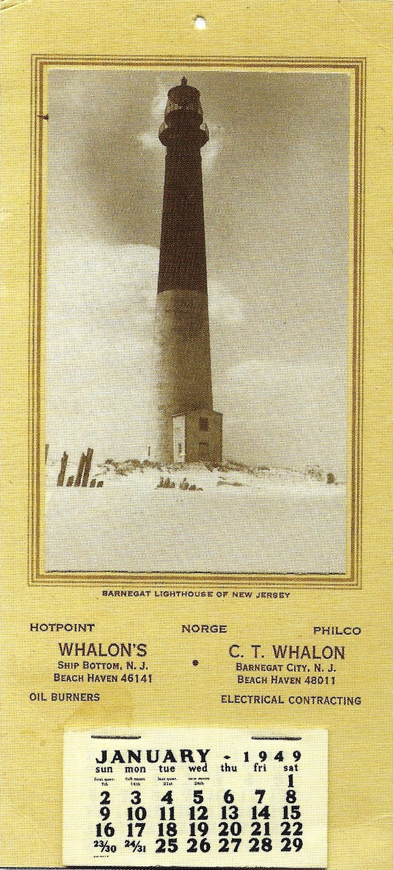
C.) Local Beach Haven merchant C. T. Whalon electrical and appliance contractors made a 1949 historic Barnegat Lighthouse Calendar.
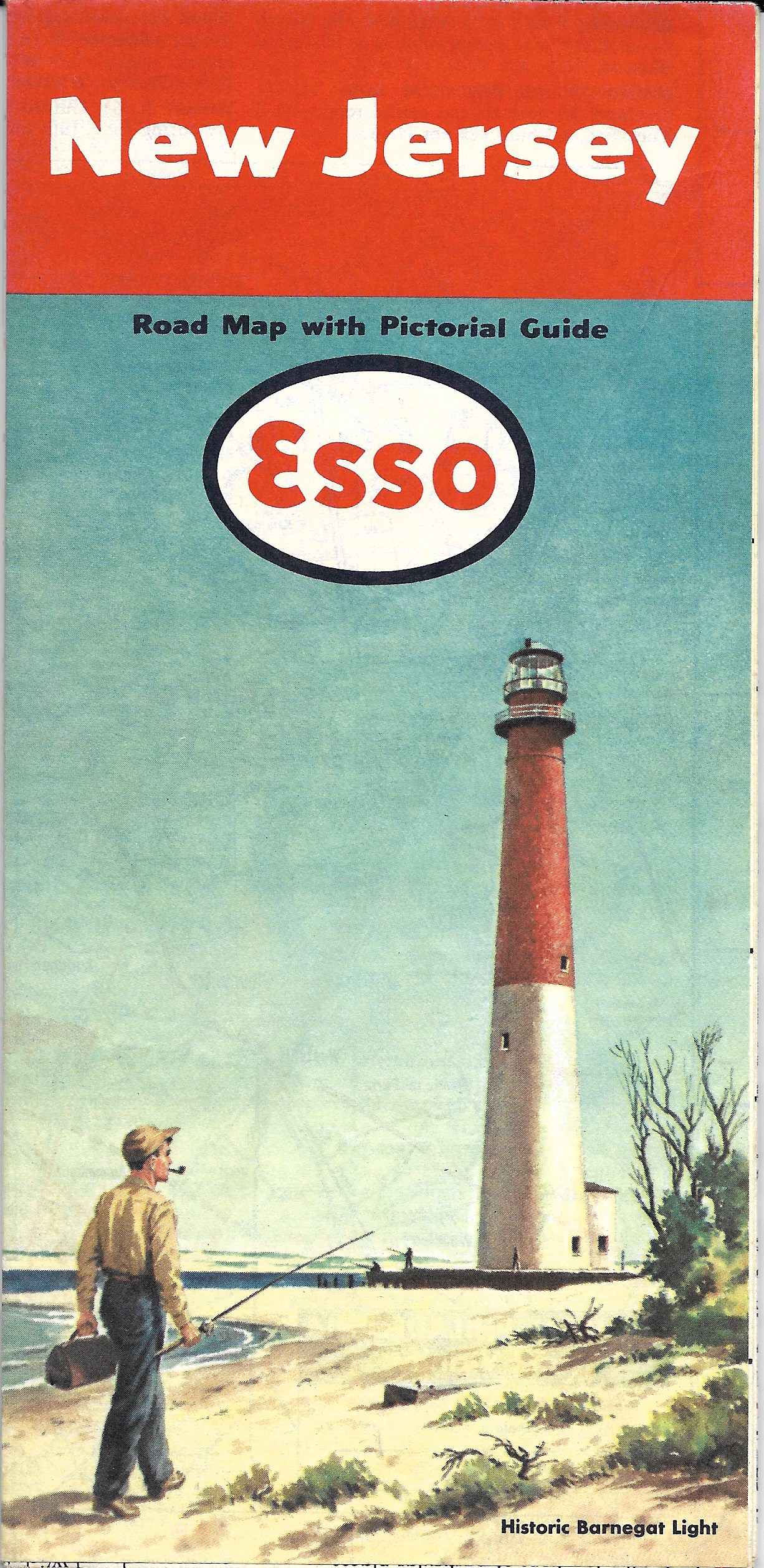
D.) ESSO Standard Oil Company distributed this 1951 New Jersey Road Map with Pictorial Guide free of charge. As they said, “Happy Motoring”.
E.) Artist Bill Kane sketched and printed a set of postcards circa 1950 consisting of 10 different sketches highlighting Barnegat Lighthouse and promoting the theme “Visit Magic Long Beach Island – Six Miles at Sea. Vacation’s Playland on the Jersey Coast.”
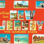
F.) Large letter postcard and map postcards each display the Barnegat Lighthouse.
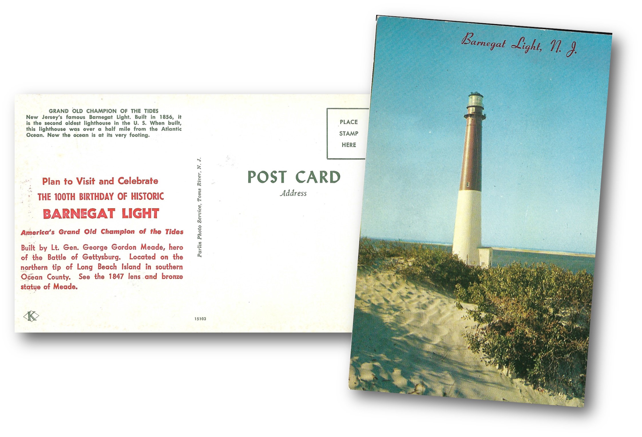
G.) Sponsored by the Ocean County Stamp Club and bearing two postmarks dated FEB. 15, 1950 from both Toms River and Barnegat Light, this postcard displays a colorful red and blue printed cachet commemorating the 1850-1950 Centennial of Ocean County.
H.) A special message overprinted in red ink announces the “100th Birthday of Historic Barnegat Light”. Referred to as “America’s Grand Old Champion of the Tides.”
I.) Souvenir Folders consisted of a fold-out grouping of a dozen or so postcard images all in one mailer. This one features 12 different views of Barnegat Lighthouse.
Such souvenir folders typically include information about the towns of Long Beach Island and promote LBI as “The Home of Happy, Healthy Sand, Sea and Sunshine” with 18 miles of sandy white beaches.
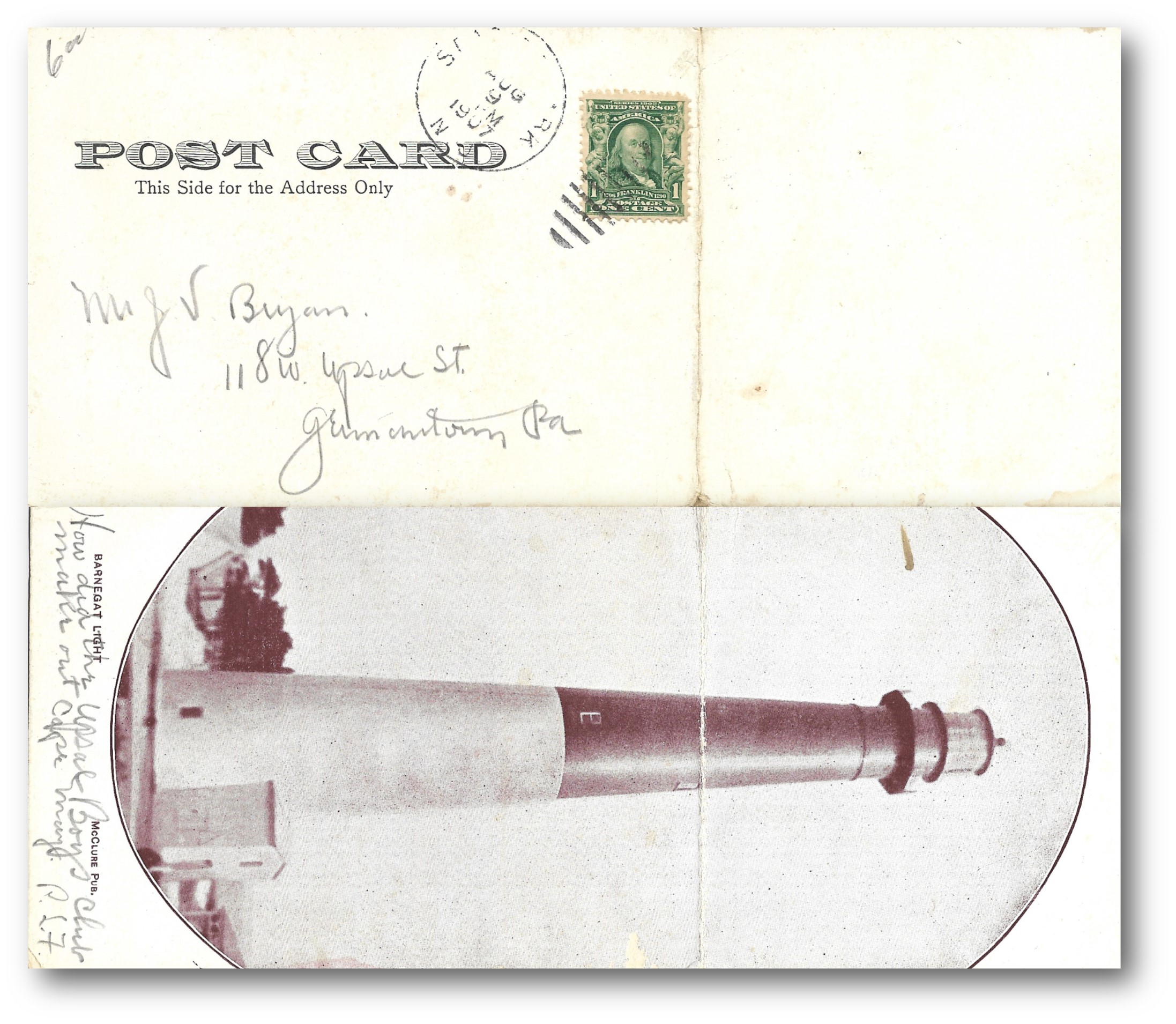
J.) Creased in the center and designed to be folded over when addressed, this postcard bears a green 1-cent Ben Franklin postage stamp and AUG. 9, 1907 postmark.
K.) Ten oversized, or jumbo, postcards measuring as much as 6-1/2 X 9 inches featuring Barnegat Lighthouse
This slideshow requires JavaScript.
L.) 17 professional color photographs courtesy of Studio 9 Photo Center, Route 9, Waretown Plaza, Waretown, NJ 08758.
M.) Note the evolution of postcard production from older postcards with white-borders to the linens to the more modern era of photochromes in this chronological sequence of postcards from 1906-1966.
Search “Barnegat Light” on YouTube and one gets dozens of results. This is one of the professionally produced productions.
Jersey beaches are open! Well, at least virtually, here at rivertonhistory.com.
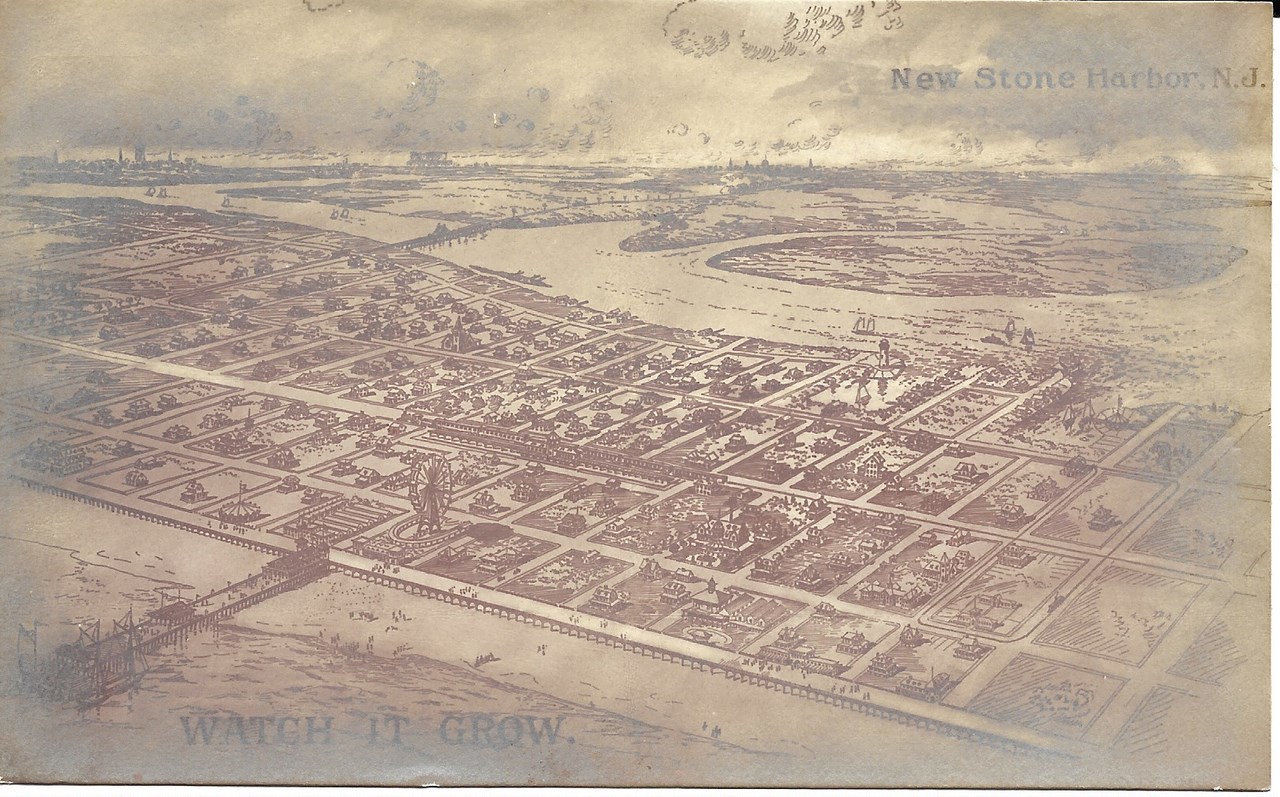
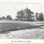
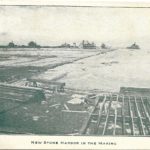
New Stone Harbor in the Making
The Rise of Stone Harbor, N. J.
by
Harlan Radford
In the late 1890s, three enterprising brothers from Philadelphia formed a business venture called the South Jersey Realty Company. Howard, David, and Reese Risley envisioned a thriving seashore resort community on an undeveloped tract of land popularly referred to as Seven Mile Island located in Cape May County.
New Stone Harbor, NJ – Watch it grow
The Risley Brothers set into motion a plan to transform this barrier island of sand dunes, wide expansive beaches, and salt marsh at the southernmost portion of the South Jersey peninsula into a popular vacation resort. Some folks referred to this new resort as being ‘Philadelphia’s Seashore Suburb.
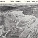
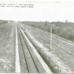
A very important part of this early development plan included providing a means for connecting Stone Harbor with the mainland. Originally, a rail line was proposed but that soon gave way to a more feasible elevated roadway. Dubbed “The Ocean Parkway” initially and later called “The Stone Harbor Ocean Parkway,” this new boulevard extending from Cape May Court House now made it possible for people to come to the island. And come they did!
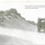
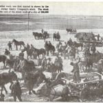
“Building the Causeway to Seven Mile Island”
Sand dunes along beach front
A dredge using sand for building the elevated Ocean Parkway linking the mainland/Cape May Court House with Stone Harbor
Let the building begin! Early work crews begin to tackle the construction of Stone Harbor
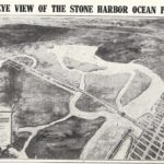
A birds-eye view of the Stone Harbor Ocean Parkway linking the mainland on the left with the island and ocean on the right
The New Stone Harbor in the making
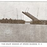
Ocean Parkway draw bridge to Stone Harbor in the open position
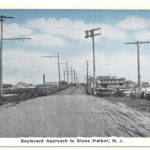
boulevard approach entering Stone Harbor
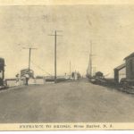
In Stone Harbor looking due west, the entrance to the bridge leading to the causeway to the mainland. Note the railroad tracks on the right of the road.
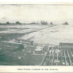
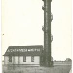
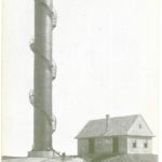
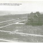
Stone Harbor water works
view of the water works providing fine artesian water drawn from a well 850 feet below the ocean
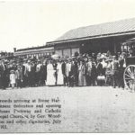
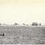
In 1911, a Gala Week of celebration scheduled for July 1 to 5 included an entire series of events of general public interest arranged as a means of promoting and featuring the many fine aspects and possibilities of the “new” Stone Harbor in the making.
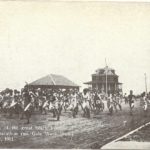
Festivities kicked off on Saturday, July 1 with competitive sailboat races open to the public and a lush dinner-dance provided at the newly opened Yacht Club. Sunday, July 2, ushered in the first religious church services at the new Episcopal and Roman Catholic churches. Monday, July 3, witnessed the dedication of the Boulevard Bridges and Canal with appropriate ceremonies attended by public officials, dignitaries, and many spectators. Included in that august group of officials would be the Governor of New Jersey, the Honorable Woodrow Wilson. Other attractions included exciting automobile races on the beachfront, a beach party with a barbecue for county granges, a water carnival, a fireworks display, and a dedication ball at the Yacht Club. Tuesday, July 4, saw a sailing Regatta followed by athletic sports, including track and aquatic events and concluding with yet another ball at the Yacht Club for the visiting athletes and yachtsmen.
The conclusion of Gala Week celebrations occurred on Wednesday, July 5. The South Jersey Realty Company offered and sold First Mortgage Beach Front Improvement Bonds at the opening price of $65 (par, $100), which advanced to $70 at the close of business that day.
Purchasers under the famous Stone Harbor Bond Plan received free fully improved lots at Stone Harbor. Thus, not only was Stone Harbor then on the map, but interested persons could invest and buy into this community enterprise.
Gala Week in Stone Harbor, July 1-5, 1911
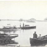
Rolling lift drawbridge over Great Channel on July 3, 1911 and ready for dedication by New Jersey Governor Woodrow Wilson
Gov. Woodrow Wilson and crowd watching the lowering of the roll lift drawbridge. The Risley Brothers on the governor’s right
Gov. Woodrow Wilson after the dedicatory services on the Great Channel drawbridge, July 3, 1911
Gov. Woodrow Wilson giving speech during Gala Week, July 1-5. 1911
Crowds witness dedication and opening of Ocean Parkway and the Catholic and Episcopal Church by Gov. Woodrow Wilson on July 2 & 3, 1911 1489: New Bridge and mainland roadway opened by Gov. Woodrow Wilson, July 3, 1911
New Bridge and mainland roadway opened by Gov. Woodrow Wilson, July 3, 1911
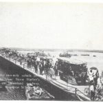
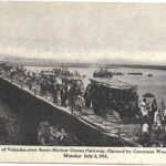
Great parade of vehicles over Ocean Parkway on day of official opening by Gov. Woodrow Wilson – Monday, July 3, 1911
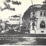
Cape May Court House decorated – July 3, 1911 – Opening of Ocean Parkway to Stone Harbor
The railway to Cape May County and west through South Jersey and on to Camden, and then by ferry to Philadelphia
View from ocean – July 1911
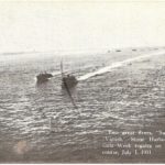
Gala Week 1911 – Regatta on Great Channel – July 1
Gala Week 1911 – Yacht Club – visiting racing craft
Fourth of July, 1911 – Marathon run during Gala Week
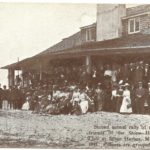
Memorial Day 1911 at Stone Harbor Yacht Club
At about this time, postcards and especially picture postcards became in vogue as a popular means to communicate by mail with relatives, friends, and neighbors. Soon the post office delivered a marvelous travelogue of images depicting new and distant places to our mailboxes. Typical postcards featured an interesting photograph on the front and space for a brief hand-written note or printed message, mailing address, and a postage stamp on the other side. Postcards served as souvenirs or keepsakes and provided an easy means of sending personal greetings as well as conveying timely commercial advertisements.
The Risley brothers devised a novel means to promote the idea of announcing their real estate venture in Stone Harbor and they connected with the public in a clever and inexpensive way. Just one cent covered the cost of mailing a postcard back then. The Risleys utilized picture postcards as a means to promote Stone Harbor and attract buyers of homes and property. They captured the attention of interested parties by mailing picture postcards describing their direct role in the construction of homes and cottages in Stone Harbor. In addition, those picture postcards also clearly document the early development of Stone Harbor.
The Building Boom in Stone Harbor
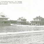
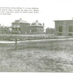
New construction – Stone Harbor has doubled its size and value in just the past six months
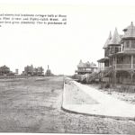
New beach front homes – Note the completed roads, sidewalks and curbing in place preparatory to home building
Early development of cottages and railroad station at 85th Street – Note new sidewalks and many sewer pipes ready to be placed in the ground
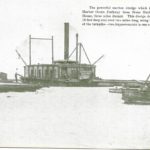
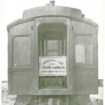
One of the special club railroad cars used to transport prospective buyers of lots for home building in Stone Harbor
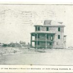
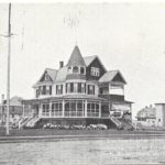
More newly constructed stately cottages including that of G. Franklin Davis
Newly erected cottage
Another newly completed residence
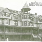
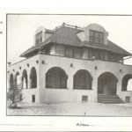
Harbor Inn – popular hostelry run by the South Jersey Realty Company
Handsome cottages viewed from First Avenue and 88th Street
New Stone Harbor in the making
Beachfront villa “Hydrangea” owned by Vice-President R. P. Risley
: Shown are some recently erected cottages at New Stone Harbor
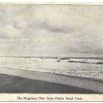
The magnificent New Stone Harbor beach front
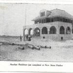
Another residence just completed at the New Stone Harbor
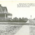
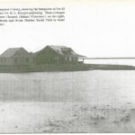
Bungalows of David Risley and Dr. E. L. Klopp commanding great views of the channel and Stone Harbor Yacht Club
New Stone Harbor in the making
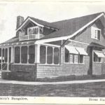
David Risley’s Bungalow
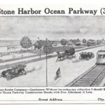
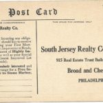
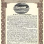
The Risley brothers’ innovative postcard advertisements pictured below show the early stages of growth and development in Stone Harbor. South Jersey Realty Company/Beach Front Improvement Investment Bonds, issued in May 1909, raised money to fund the beginning construction of needed infrastructure including streets, sidewalks, sewers, water supply, and electric power in Stone Harbor. Each beautifully steel-engraved certificate bore actual penned signatures of David Risley, Secretary, and H.S. Risley, President, and guaranteed the purchaser the return of $100, payable on December 1, 1927.
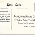
South Jersey Realty Company advertising postcards and bond
Picture side of postcard showing Ocean Parkway and vehicles along with space provided for interested party to write their name and mailing address
Address side of postcard properly stamped for mailing to South Jersey Realty Company in Philadelphia
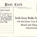
modified version of the SJRCo. postcard message
A slightly differently worded SJRCo. advertising postcard
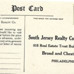
SJRCo. advertising postcard variety and with a vintage one-cent Franklin postage stamp affixed but apparently unmailed
SJRCo. advertising postcard
South Jersey Realty Company advertising reply post card showing artist’s rendering of aerial view of Stone Harbor Ocean Parkway with mainland on the left and Stone Harbor and the ocean on the right connected by vehicular causeway
message side of SJRCo post card with artist rendering of aerial view of Stone Harbor
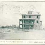
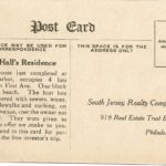
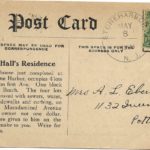
Message/Address side of promotional picture postcard showing just completed residence in the New Stone Harbor
photo side of promotional picture postcard showing just completed residence in the New Stone Harbor
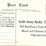
variation of a SJRCo postcard message
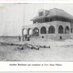
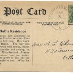
postcard announcing successful completion of Mr. Hall’s Residence and soliciting new property owners
scan of authentic $100 Beach Front Improvement Bond certificate issued by the SJRCo
with actual signatures of David Risley, Secty. and H.S. Risley, Pres.
Boosted by the rise in popularity of picture postcards, Stone Harbor became incorporated just five years later in 1914. The Risley brothers’ brilliantly conceived real estate venture grew to become a unique South Jersey resort and adopted the slogan, “The Seashore at its Best.”
The advent of the automobile, the construction of major, multi-lane highways and toll roads, along with the emphasis on enjoying the leisure benefits of the Jersey Shore directly contributed to the Stone Harbor we have all come to know today.


